IMAGES TAKEN NEAR TO
Kings Close, BARNSTAPLE, EX32 9FG
Introduction
This page details the photographs taken nearby to Kings Close, EX32 9FG by members of the Geograph project.
The Geograph project started in 2005 with the aim of publishing, organising and preserving representative images for every square kilometre of Great Britain, Ireland and the Isle of Man.

There are currently over 7.5m images from over14,400 individuals and you can help contribute to the project by visiting https://www.geograph.org.uk
Image Map
Images are licensed for reuse under creativecommons.org/licenses/by-sa/2.0
Notes
- Clicking on the map will re-center to the selected point.
- The higher the marker number, the further away the image location is from the centre of the postcode.
Image Listing (65 Images Found)
Images are licensed for reuse under creativecommons.org/licenses/by-sa/2.0
Image
Details
Distance
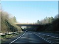
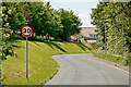
4
The A361 passing underneath Landkey Road
Image: © Roger A Smith
Taken: 16 Feb 2012
0.05 miles
5
North Devon Hospice is 30 years of age this year
Image: © Roger A Smith
Taken: 15 May 2014
0.08 miles
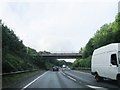
6
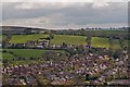
The Lankey Road runs across the image above houses north west of the A361
Image: © Roger A Smith
Taken: 27 Apr 2012
0.08 miles
7

The second phase of Mount Sandford Green, a housing development on the Landkey Road
Image: © Roger A Smith
Taken: 18 Jun 2019
0.08 miles

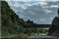
9
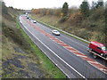
A39 Barnstaple by-pass
Viewed from the Landkey road bridge.
Image: © Jonathan Billinger
Taken: 27 Nov 2007
0.09 miles
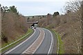
10
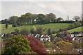
Houses on River View, Lankey Road, Barnstaple
Image: © Roger A Smith
Taken: 8 May 2012
0.10 miles