IMAGES TAKEN NEAR TO
Abyssinia Terrace, BARNSTAPLE, EX32 9BH
Introduction
This page details the photographs taken nearby to Abyssinia Terrace, EX32 9BH by members of the Geograph project.
The Geograph project started in 2005 with the aim of publishing, organising and preserving representative images for every square kilometre of Great Britain, Ireland and the Isle of Man.

There are currently over 7.5m images from over14,400 individuals and you can help contribute to the project by visiting https://www.geograph.org.uk
Image Map (Loading...)


Getting Data...Please wait
Leaflet Map data © OpenStreetMap
Images are licensed for reuse under creativecommons.org/licenses/by-sa/2.0
Notes
- Clicking on the map will re-center to the selected point.
- The higher the marker number, the further away the image location is from the centre of the postcode.
Image Listing (124 Images Found)
Images are licensed for reuse under creativecommons.org/licenses/by-sa/2.0
Image
Details
Distance

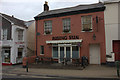
2
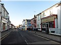
The Old Dairy and Barn Antiques, Newport Road, Barnstaple
Grade II listed building, English Heritage Building ID: 485692.
Possibly the only remaining thatched roof in Barnstaple.
Image: © Roger A Smith
Taken: 16 Jun 2016
0.03 miles
3
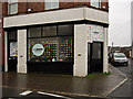
A re:store pop-up charity shop in Newport Road, Barnstaple
Re:store shops raise money for NADA (North Devon Against Domestic Abuse).
Image: © Roger A Smith
Taken: 20 Mar 2017
0.03 miles
4
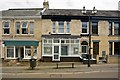
The Religious Society of Friends (Quakers), 21 Newport Road, Barnstaple
See also:Image
Image: © Roger A Smith
Taken: 16 Jun 2016
0.03 miles
5
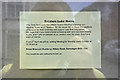
A notice at the Religious Society of Friends (Quakers), 21 Newport Road, Barnstaple
See also: Image
Image: © Roger A Smith
Taken: 16 Jun 2016
0.03 miles
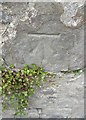
6

Ordnance Survey Cut Mark
This OS cut mark can be found on No19 Newport Road. It marks a point 14.091m above mean sea level.
Image: © Adrian Dust
Taken: 4 Jul 2016
0.03 miles
8
Ordnance Survey Cut Mark
This OS cut mark can be found on the NW wall of Prospect Place. It marks a point 20.854m above mean sea level.
Image: © Adrian Dust
Taken: 4 Jul 2016
0.04 miles
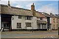
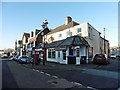
9
The Rising Sun, Newport Road, Barnstaple
Image: © Robert Eva
Taken: 28 Jul 2017
0.05 miles