
IMAGES TAKEN NEAR TO
Brayford, BARNSTAPLE, EX32 7PN
Introduction
This page details the photographs taken nearby to EX32 7PN by members of the Geograph project.
The Geograph project started in 2005 with the aim of publishing, organising and preserving representative images for every square kilometre of Great Britain, Ireland and the Isle of Man.

There are currently over 7.5m images from over14,400 individuals and you can help contribute to the project by visiting https://www.geograph.org.uk
Image Map
Images are licensed for reuse under creativecommons.org/licenses/by-sa/2.0
Notes
- Clicking on the map will re-center to the selected point.
- The higher the marker number, the further away the image location is from the centre of the postcode.
Image Listing (7 Images Found)
Images are licensed for reuse under creativecommons.org/licenses/by-sa/2.0
Image
Details
Distance
1
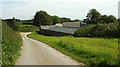
Stoodleigh Barton
The "farmhouse, including lofted outbuilding, linhay and farm courtyard walls" are listed https://historicengland.org.uk/listing/the-list/list-entry/1161286 . "Farmhouse probably mid to late C17. Outbuildings late C18/early C19."
Image: © Derek Harper
Taken: 22 Jun 2019
0.01 miles
2
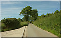
Lane at Stoodleigh Barton
Looking in the opposite direction to Image
Image: © Derek Harper
Taken: 22 Jun 2019
0.09 miles
3
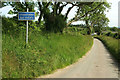
Lane to Whitsford
Image: © Derek Harper
Taken: 22 Jun 2019
0.12 miles
4
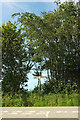
Signpost near Stoodleigh Barton
Considering that most such junctions in these parts have a name, and two nearby are blessed with two each (Image]), it is surprising that this one seems to have none. The junction just perceptible in the background of Image
Image: © Derek Harper
Taken: 22 Jun 2019
0.14 miles
5
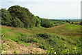
Venn Brook valley
The stream is in its infancy; the source is about 220 metres behind the camera. I was going to say "a headwater of the Venn Brook", but looking at the map this is clearly the major tributary - see Image Taken looking right from Image The trees along the right side of the valley have been felled in recent times.
Image: © Derek Harper
Taken: 22 Jun 2019
0.21 miles
6
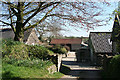
West Buckland: Whitsford
Entrance to the farm, looking south. A barn here at one time had machinery powered by a waterwheel
Image: © Martin Bodman
Taken: 18 Apr 2007
0.24 miles
7
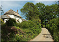
Hoops Cottage
The cottage is listed and described at https://historicengland.org.uk/listing/the-list/list-entry/1107565 . The lane is from Stone Cross to Wistford Cross.
Image: © Derek Harper
Taken: 22 Jun 2019
0.24 miles