
IMAGES TAKEN NEAR TO
Bratton Fleming, BARNSTAPLE, EX32 7LQ
Introduction
This page details the photographs taken nearby to EX32 7LQ by members of the Geograph project.
The Geograph project started in 2005 with the aim of publishing, organising and preserving representative images for every square kilometre of Great Britain, Ireland and the Isle of Man.

There are currently over 7.5m images from over14,400 individuals and you can help contribute to the project by visiting https://www.geograph.org.uk
Image Map
Images are licensed for reuse under creativecommons.org/licenses/by-sa/2.0
Notes
- Clicking on the map will re-center to the selected point.
- The higher the marker number, the further away the image location is from the centre of the postcode.
Image Listing (4 Images Found)
Images are licensed for reuse under creativecommons.org/licenses/by-sa/2.0
Image
Details
Distance
1

Bales on the move, Mockham Down
A pair of tractors and trailers, in fact, passing the entrance to the house on Mockham Down. The lane is used by NCN3; hopefully not many cyclists were using it while this convoy went past.
Image: © Derek Harper
Taken: 22 Jun 2019
0.05 miles
2

Stoke Rivers: on Mockham Down
Looking south-south-west with Dartmoor on the horizon, left
Image: © Martin Bodman
Taken: 24 Jul 2007
0.12 miles
3

Farmland on Mockham Down
Through a gateway at the spot where Image] was taken. In the distance is a wind turbine near Barnacott.
Image: © Derek Harper
Taken: 22 Jun 2019
0.17 miles
4
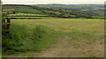
Farmland on Mockham Down
Looking through a gateway to the right of Image Away on the left is the road to Stoke Rivers.
Image: © Derek Harper
Taken: 22 Jun 2019
0.20 miles