
IMAGES TAKEN NEAR TO
Wimborne Terrace, BARNSTAPLE, EX32 7AN
Introduction
This page details the photographs taken nearby to Wimborne Terrace, EX32 7AN by members of the Geograph project.
The Geograph project started in 2005 with the aim of publishing, organising and preserving representative images for every square kilometre of Great Britain, Ireland and the Isle of Man.

There are currently over 7.5m images from over14,400 individuals and you can help contribute to the project by visiting https://www.geograph.org.uk
Image Map
Images are licensed for reuse under creativecommons.org/licenses/by-sa/2.0
Notes
- Clicking on the map will re-center to the selected point.
- The higher the marker number, the further away the image location is from the centre of the postcode.
Image Listing (132 Images Found)
Images are licensed for reuse under creativecommons.org/licenses/by-sa/2.0
Image
Details
Distance
1
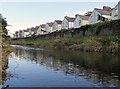
Lansdown Terrace, St. Georges Road as seen from the river Yeo
See also: Image
Image: © Roger A Smith
Taken: 15 Oct 2013
0.02 miles
2
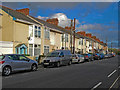
Lansdown Terrace on St. George's Road
See also: Image
Image: © Roger A Smith
Taken: 24 Dec 2013
0.03 miles
3

River Yeo in Raleigh
The Raleigh area of the suburbs of Barnstaple lies between the river and the A39, up to the left. Barnstaple Footpath 34 sets out along the left side of the river from Green Meadow Drive.
Image: © Derek Harper
Taken: 1 Jun 2009
0.03 miles
4
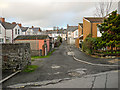
Rear access to properties on Carlyle Avenue
Image: © Roger A Smith
Taken: 24 Dec 2013
0.04 miles
5
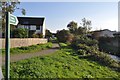
A footpath between Green Meadow Drive and the River Yeo
Image: © Roger A Smith
Taken: 22 Oct 2011
0.04 miles
6
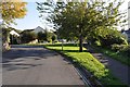
Raleigh Road at the junction with Green Meadow Drive
Image: © Roger A Smith
Taken: 22 Oct 2011
0.05 miles
7

Ordnance Survey Cut Mark
This OS cut mark can be found on the north side of Raleigh Road. It marks a point 7.279m above mean sea level.
Image: © Adrian Dust
Taken: 8 Jul 2016
0.07 miles
8

Barnstaple : Greenmeadow Open Space
A gathering at a grassy open space in Barnstaple where people want to save the land from being developed.
Image: © Lewis Clarke
Taken: 7 Mar 2022
0.07 miles
9

Barnstaple : Greenmeadow Open Space
A space which is blocked off for public due to the stream and drainage here.
Image: © Lewis Clarke
Taken: 7 Mar 2022
0.08 miles
10

Barnstaple : Greenmeadow Green
Looking towards people playing in an open space.
Image: © Lewis Clarke
Taken: 7 Mar 2022
0.08 miles