IMAGES TAKEN NEAR TO
Carrington Terrace, BARNSTAPLE, EX32 7AE
Introduction
This page details the photographs taken nearby to Carrington Terrace, EX32 7AE by members of the Geograph project.
The Geograph project started in 2005 with the aim of publishing, organising and preserving representative images for every square kilometre of Great Britain, Ireland and the Isle of Man.

There are currently over 7.5m images from over14,400 individuals and you can help contribute to the project by visiting https://www.geograph.org.uk
Image Map
Images are licensed for reuse under creativecommons.org/licenses/by-sa/2.0
Notes
- Clicking on the map will re-center to the selected point.
- The higher the marker number, the further away the image location is from the centre of the postcode.
Image Listing (239 Images Found)
Images are licensed for reuse under creativecommons.org/licenses/by-sa/2.0
Image
Details
Distance
1
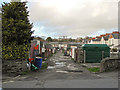
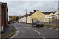
Rear access to properties on Kingsley and Carlyle Avenues
Image: © Roger A Smith
Taken: 24 Dec 2013
0.04 miles
2
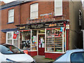
Yeo Vale Stores, 1 Margrove Terrace, Yeo Vale Road, Barnstaple
Image: © Roger A Smith
Taken: 24 Dec 2013
0.06 miles
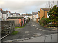
3
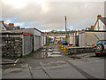
Rear access to properties on Granville and Kingsley Avenues
Image: © Roger A Smith
Taken: 24 Dec 2013
0.06 miles
4
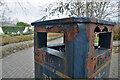
Barnstaple : Bin
A rusty bin on Coronation Street.
Image: © Lewis Clarke
Taken: 19 Mar 2021
0.06 miles
6
Rear access to properties on Carlyle Avenue
Image: © Roger A Smith
Taken: 24 Dec 2013
0.07 miles

8
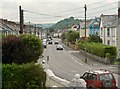
St. Georges Road near Granville Avenue and Kingsley Avenue
Image: © Roger A Smith
Taken: 14 Jun 2012
0.08 miles
9
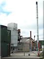
Derby Lace Factory, Barnstaple in 2013
In 2013 a working textile mill in the south-west was a rare sight. This was opened in 1825 by John Boden and was part of the Heathcoat empire based in Tiverton. Lace was last made in 1970 but synthetics fibres were still knitted here and there was a factory shop. The site closed later in 2013 and is now to be redeveloped as housing but with retention of the more historic fabric.
This view of the site's chimneys is already no longer possible as the aerial view shows the chimneys, tanks and containers seen in this view have already been swept away.
Image: © Chris Allen
Taken: 23 Apr 2013
0.08 miles
10
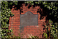
A plaque marking the opening of the Barnstaple Urban Relief Road
Image: © Roger A Smith
Taken: 28 Sep 2011
0.09 miles