IMAGES TAKEN NEAR TO
Swallow Field, BARNSTAPLE, EX31 3XB
Introduction
This page details the photographs taken nearby to Swallow Field, EX31 3XB by members of the Geograph project.
The Geograph project started in 2005 with the aim of publishing, organising and preserving representative images for every square kilometre of Great Britain, Ireland and the Isle of Man.

There are currently over 7.5m images from over14,400 individuals and you can help contribute to the project by visiting https://www.geograph.org.uk
Image Map (Loading...)


Getting Data...Please wait
Leaflet Map data © OpenStreetMap
Images are licensed for reuse under creativecommons.org/licenses/by-sa/2.0
Notes
- Clicking on the map will re-center to the selected point.
- The higher the marker number, the further away the image location is from the centre of the postcode.
Image Listing (32 Images Found)
Images are licensed for reuse under creativecommons.org/licenses/by-sa/2.0
Image
Details
Distance
1
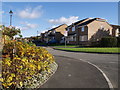
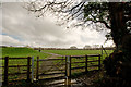
Swallowfield, Bickington
Part of a large area of new housing alongside Tews Lane southwest of Barnstaple.
Image: © Derek Harper
Taken: 30 Oct 2007
0.08 miles
2
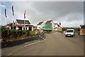
Another housing development in North Devon
Image: © Roger A Smith
Taken: 9 Mar 2017
0.10 miles
3
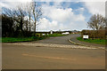
Queen Elizabeth II Playing Fields Tews Lane
Image: © Roger A Smith
Taken: 9 Mar 2017
0.11 miles
4
Another housing development in North Devon
Image: © Roger A Smith
Taken: 9 Mar 2017
0.13 miles
5
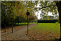
Queen Elizabeth II Playing Fields Tews Lane
Image: © Roger A Smith
Taken: 9 Mar 2017
0.15 miles
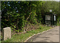
8

Old Milestone by Old Bideford Road, Roundwell
Carved stone post by the UC road, in parish of FREMINGTON (NORTH DEVON District), Old Bideford Road, Roundwell, opposite Hazeldene, by bus stop, 20m West of Meadow Brook junction, on grass at centre of bus lay-by, on North side of road. Barum tombstone, erected by the Barnstaple turnpike trust in the 19th century.
Inscription reads:-
2
BARUM
Carved benchmark on face.
Milestone Society National ID: DV_BFBS07
Image: © Alan Rosevear
Taken: 8 Feb 2013
0.15 miles
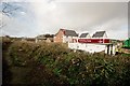
9
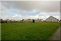
Queen Elizabeth II Playing Fields Tews Lane
A new housing development is visible in the background.
Image: © Roger A Smith
Taken: 9 Mar 2017
0.16 miles
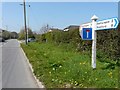
10
A spur leading off from a cycle and footpath between Tews Lane and Roundswell
This spur leads to Cedar Grove.
Image: © Roger A Smith
Taken: 18 Oct 2020
0.18 miles