IMAGES TAKEN NEAR TO
Barton Cleave, BARNSTAPLE, EX31 3GT
Introduction
This page details the photographs taken nearby to Barton Cleave, EX31 3GT by members of the Geograph project.
The Geograph project started in 2005 with the aim of publishing, organising and preserving representative images for every square kilometre of Great Britain, Ireland and the Isle of Man.

There are currently over 7.5m images from over14,400 individuals and you can help contribute to the project by visiting https://www.geograph.org.uk
Image Map (Loading...)


Getting Data...Please wait
Leaflet Map data © OpenStreetMap
Images are licensed for reuse under creativecommons.org/licenses/by-sa/2.0
Notes
- Clicking on the map will re-center to the selected point.
- The higher the marker number, the further away the image location is from the centre of the postcode.
Image Listing (19 Images Found)
Images are licensed for reuse under creativecommons.org/licenses/by-sa/2.0
Image
Details
Distance
2

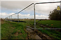
A field between Conners Farm and a footpath
Higher Gorse Claypits are at the other end of this field.
Image: © Roger A Smith
Taken: 9 Mar 2017
0.06 miles
3

A footpath running alongside Wedlake Way
See also: Image
Image: © Roger A Smith
Taken: 22 May 2021
0.07 miles
4
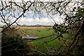
A field beside a footpath
This field is in close proximity to others which are having houses built on them.
Image: © Roger A Smith
Taken: 9 Mar 2017
0.07 miles
5
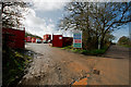
Part of a housing development alongside the Old Bideford Road
See also: Image
Image: © Roger A Smith
Taken: 9 Mar 2017
0.10 miles
6
A field beside Tews Lane and the Old Bideford Road upon which houses are to be built
Image: © Roger A Smith
Taken: 9 Mar 2017
0.12 miles
7

Claypits Covert Cross where Tews Lane and the Old Bideford Road meet
See also: Image
Image: © Roger A Smith
Taken: 22 May 2021
0.13 miles
8
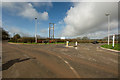
Claypits Covert Cross where Tews Lane and the Old Bideford Road meet
This area is subject to much development with many new homes being built.
Image: © Roger A Smith
Taken: 9 Mar 2017
0.13 miles
9

Glenwood Drive at the junction with the Old Bideford Road
A new development which is continuing to extend further westward.
Image: © Roger A Smith
Taken: 9 Mar 2017
0.13 miles
10
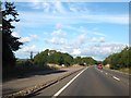
Lay-by for eastbound A39 traffic at Rook's Bridge
The lay-by is protected from the traffic by a small bank, studded with stones.
Image: © David Smith
Taken: 19 Aug 2013
0.14 miles