
IMAGES TAKEN NEAR TO
The Rock, BARNSTAPLE, EX31 1PN
Introduction
This page details the photographs taken nearby to The Rock, EX31 1PN by members of the Geograph project.
The Geograph project started in 2005 with the aim of publishing, organising and preserving representative images for every square kilometre of Great Britain, Ireland and the Isle of Man.

There are currently over 7.5m images from over14,400 individuals and you can help contribute to the project by visiting https://www.geograph.org.uk
Image Map
Images are licensed for reuse under creativecommons.org/licenses/by-sa/2.0
Notes
- Clicking on the map will re-center to the selected point.
- The higher the marker number, the further away the image location is from the centre of the postcode.
Image Listing (190 Images Found)
Images are licensed for reuse under creativecommons.org/licenses/by-sa/2.0
Image
Details
Distance
1
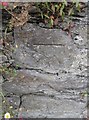
Ordnance Survey Cut Mark
This OS cut mark can be found on the wall below No46 Pilton Road. It marks a point 24.777m above mean sea level.
Image: © Adrian Dust
Taken: 8 Jul 2016
0.01 miles
2
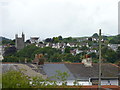
Pilton from swing bridge over the River Yeo
Image: © Jeff Gogarty
Taken: 7 Aug 2017
0.01 miles
3

Higher Raleigh Road near its junction with The Rock
Image: © Roger A Smith
Taken: 20 Jul 2012
0.04 miles
4
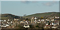
St. Mary's Church, Pilton
Between the two hills in the background runs Bradiford Water. The wood on the hill to the left is Tutshill Wood.
Image: © Roger A Smith
Taken: 25 Mar 2015
0.05 miles
5

The church of St Mary the Virgin, Pilton
Image: © Roger A Smith
Taken: 25 Mar 2016
0.05 miles
6

The church of St. Mary, Pilton
The houses to the left are in Ashford.
Image: © Roger A Smith
Taken: 16 Feb 2016
0.05 miles
7

A yard of change
The graveyard of St Mary's started out as a Benedictine priory before the Dissolution under Henry VIII. It then passed into the hands of the Chichester Family of Raleigh Manor, who installed some fine memorials. Grade I listed.
Image: © Neil Owen
Taken: 9 Jun 2023
0.05 miles
8

Barnstaple : Feoffee Cottages and Church Cottage
Row of almshouses "enlarged and rebuilt by the Reverend Thomas Boweller, 20 May 1849" (wall plaque). Probably C17 in origin.
Image: © Lewis Clarke
Taken: 3 Oct 2022
0.05 miles
10
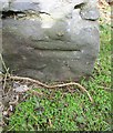
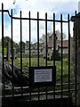
Ordnance Survey Cut Mark
This OS cut mark can be found on the east face of St Mary's Church. It marks a point 24.287m above mean sea level.
Image: © Adrian Dust
Taken: 8 Jul 2016
0.05 miles