
IMAGES TAKEN NEAR TO
Rolle Quay, BARNSTAPLE, EX31 1JE
Introduction
This page details the photographs taken nearby to Rolle Quay, EX31 1JE by members of the Geograph project.
The Geograph project started in 2005 with the aim of publishing, organising and preserving representative images for every square kilometre of Great Britain, Ireland and the Isle of Man.

There are currently over 7.5m images from over14,400 individuals and you can help contribute to the project by visiting https://www.geograph.org.uk
Image Map
Images are licensed for reuse under creativecommons.org/licenses/by-sa/2.0
Notes
- Clicking on the map will re-center to the selected point.
- The higher the marker number, the further away the image location is from the centre of the postcode.
Image Listing (766 Images Found)
Images are licensed for reuse under creativecommons.org/licenses/by-sa/2.0
Image
Details
Distance
1
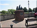
Rolle Quay Barnstaple - rebuilt 1987
On the north bank of the River Yeo. The plaque showing ROLLE QUAY BARNSTAPLE REBUILT 1987
is on a brick structure below a sailing vessel silhouette.
Image: © Jaggery
Taken: 23 Jul 2019
0.01 miles
2
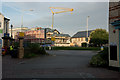
New flats under construction on Brunswick Wharf, Rolle's Quay
http://brunswickwharf.com/index.php
Image: © Roger A Smith
Taken: 9 Sep 2016
0.02 miles
3
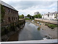
The view downstream from Braunton Bridge on the River Yeo
This River Yeo is one of four in Devon with the same name (that I am aware of). It starts near Berry Down and feeds into the Taw estuary at Barnstaple.
Image: © Roger A Smith
Taken: 13 May 2010
0.02 miles
4

Downstream along the Yeo, Barnstaple
Viewed from Rolle Bridge. The River Yeo is a tributary of the much wider River Taw.
Their confluence is out of shot about 400 metres from the camera.
Image: © Jaggery
Taken: 23 Jul 2019
0.02 miles
5

The Devon Air Ambulance flying over Barnstaple
Image: © Roger A Smith
Taken: 3 Apr 2024
0.02 miles
6
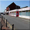
Andrew Grant Automobiles Services, Barnstaple
Viewed across Rolle Quay on the north bank of the River Yeo.
Image: © Jaggery
Taken: 23 Jul 2019
0.02 miles
7

Looking up the river Yeo between the swing bridge and Braunton Road bridge
Image: © Roger A Smith
Taken: 21 Jul 2015
0.02 miles
8

A view of Barnstaple across Taw Bridge
To the left is part of the Pottington Industrial Estate. Mill Road is in the centre and the Civic Centre is to the right.
Image: © Roger A Smith
Taken: 23 Nov 2011
0.03 miles
9

River Yeo, downstream from Rolle Street bridge
Image: © Jeff Gogarty
Taken: 7 Aug 2017
0.03 miles
10
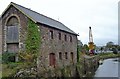
Brunswick Wharf and Gould's Yard, Barnstaple
Brunswick Wharf belonged to Mr William Gould, a local builder and timber merchant.Here barges discharged sand and gravel dredged from the nearby Taw Estuary. Mr Gould's residence, "Northgate House", stood between the warehouse in the picture and North Walk/Rolle St. Until it closed in 1935, the Lynton and Barnstaple Railway track ran between the warehouse and Northgate House and crossed Rolle St by a gate controlled crossing.
Image: © Maurice Clements
Taken: 28 Oct 2006
0.03 miles