
IMAGES TAKEN NEAR TO
Castle Street, BARNSTAPLE, EX31 1ET
Introduction
This page details the photographs taken nearby to Castle Street, EX31 1ET by members of the Geograph project.
The Geograph project started in 2005 with the aim of publishing, organising and preserving representative images for every square kilometre of Great Britain, Ireland and the Isle of Man.

There are currently over 7.5m images from over14,400 individuals and you can help contribute to the project by visiting https://www.geograph.org.uk
Image Map
Images are licensed for reuse under creativecommons.org/licenses/by-sa/2.0
Notes
- Clicking on the map will re-center to the selected point.
- The higher the marker number, the further away the image location is from the centre of the postcode.
Image Listing (1475 Images Found)
Images are licensed for reuse under creativecommons.org/licenses/by-sa/2.0
Image
Details
Distance
1

Looking across the rooftops of buildings on North Walk
Image: © Roger A Smith
Taken: 10 Sep 2015
0.01 miles
2
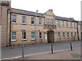
Borough of Barnstaple Electricity Works - Castle Street
Image: © Betty Longbottom
Taken: 12 May 2017
0.01 miles
3
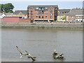
A handy perch on the river
A few ghostly branches reach out from the Taw, forming a perch for the seabirds.
Image: © Neil Owen
Taken: 9 Jun 2023
0.01 miles
4
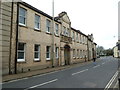
Former power station, Barnstaple
This fine yellow brick building is part of the former power station built in 1903 with an extension in 1937. These are the office blocks on Castle street. As built it housed reciprocating engines - later supplemented by diesel sets. The station closed in the 1950s.
Image: © Chris Allen
Taken: 23 Apr 2013
0.02 miles
5
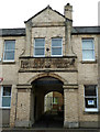
Former electricity works, Barnstaple
This fine yellow brick building is part of the former power station built in 1903 with an extension in 1937. These are the office blocks on Castle street. As built it housed reciprocating engines - later supplemented by diesel sets. The station closed in the 1950s. It is now accommodation
Image: © Chris Allen
Taken: 23 Apr 2013
0.02 miles
6

Power on the bank of the Taw
A substation right on the Taw.
Image: © Neil Owen
Taken: 9 Jun 2023
0.02 miles

8
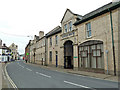
Castle Street, Barnstaple
The range of building on the right is the former power station dating from 1903and originally using reciprocating steam engines and later diesel engines. These buildings were the offices and are now accommodation.
Image: © Chris Allen
Taken: 23 Apr 2013
0.02 miles

10

A riverside walkway, Barnstaple
The South West Coast Path follows this walkway beside the River Taw, however, this can now be omitted by crossing the new bridge opened in 2007 which is just downstream. Barnstaple Long Bridge can be seen in the background on the right.
Image: © Philip Halling
Taken: 10 Jun 2009
0.03 miles