
IMAGES TAKEN NEAR TO
Dunchideock, EXETER, EX2 9UQ
Introduction
This page details the photographs taken nearby to EX2 9UQ by members of the Geograph project.
The Geograph project started in 2005 with the aim of publishing, organising and preserving representative images for every square kilometre of Great Britain, Ireland and the Isle of Man.

There are currently over 7.5m images from over14,400 individuals and you can help contribute to the project by visiting https://www.geograph.org.uk
Image Map
Images are licensed for reuse under creativecommons.org/licenses/by-sa/2.0
Notes
- Clicking on the map will re-center to the selected point.
- The higher the marker number, the further away the image location is from the centre of the postcode.
Image Listing (13 Images Found)
Images are licensed for reuse under creativecommons.org/licenses/by-sa/2.0
Image
Details
Distance
1
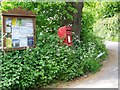
Village notice board, Dunchideock
The notice board stands beside the postbox near Dunchideock Bridge.
Image: © Maigheach-gheal
Taken: 12 May 2009
0.14 miles
2
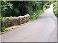
Dunchideock Bridge
A small single span bridge takes the minor road over an unnamed stream.
Image: © Maigheach-gheal
Taken: 12 May 2009
0.15 miles
3

Horse chestnut candle, Dunchideock
The flowering spikes or candles, blossom from early May. It bears up to 100 male or bisexual flowers on each candle. The flowers made up of four or five petals, the white flower is tinged with yellow blotches that turn red after the flower is pollinated.
Image: © Maigheach-gheal
Taken: 12 May 2009
0.15 miles
5

Old Bridge Marker near Dunchideock House, Exeter
Bridge Marker by the UC road, in parish of Dunchideock (Teignbridge District), Southwest of Manstree Cross, 80m Northeast of the bridge over River Kenn, just up from entrance to Dunchideock House, set in a stone faced bank, close to road edge, South side of road.
Surveyed
Milestone Society National ID: DV_EXDC03br
Image: © Alan Rosevear
Taken: 3 Feb 2013
0.17 miles
6
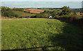
Field by Leachway Lane Cross
The lane to the right is shown in Image Footpath Dunchideock 103 runs across this field from right to left. The Kenn valley is ahead.
Image: © Derek Harper
Taken: 25 Sep 2018
0.21 miles
7
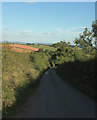
Lane to Biddypark Lane Cross
From Leachway Lane Cross. The junction at Biddypark Lane Cross is visible as a sunlit patch 90 metres down the lane.
Image: © Derek Harper
Taken: 25 Sep 2018
0.22 miles
8

Field, Dunchideock
A view from the telephone box shown in Image] across the Kenn valley.
Image: © Derek Harper
Taken: 15 Feb 2019
0.22 miles
9
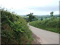
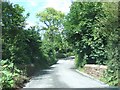
Road east from Leachway Lane Cross
The road leads to Dunchideock
Image: © David Smith
Taken: 30 May 2011
0.22 miles
10

View from lane from Ide to Dunchideock
Image: © Robin Webster
Taken: 7 Sep 2019
0.23 miles