IMAGES TAKEN NEAR TO
Water Lane, EXETER, EX2 8BZ
Introduction
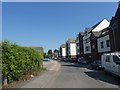
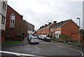
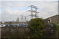
This page details the photographs taken nearby to Water Lane, EX2 8BZ by members of the Geograph project.
The Geograph project started in 2005 with the aim of publishing, organising and preserving representative images for every square kilometre of Great Britain, Ireland and the Isle of Man.

There are currently over 7.5m images from over14,400 individuals and you can help contribute to the project by visiting https://www.geograph.org.uk
Image Map
Images are licensed for reuse under creativecommons.org/licenses/by-sa/2.0
Notes
- Clicking on the map will re-center to the selected point.
- The higher the marker number, the further away the image location is from the centre of the postcode.
Image Listing (304 Images Found)
Images are licensed for reuse under creativecommons.org/licenses/by-sa/2.0
Image
Details
Distance
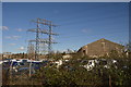
1

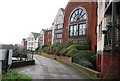
Commercial property, Water Lane, Exeter
Image: © David Smith
Taken: 25 Jun 2020
0.02 miles


9
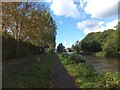
Exeter Canal with autumn colour
The left bank of the canal is part of the Exe Valley Way. The white tower is part of a block of flats.
Image: © David Smith
Taken: 14 Oct 2012
0.06 miles
