
IMAGES TAKEN NEAR TO
Sleepy Hollow, EXETER, EX2 7DJ
Introduction
This page details the photographs taken nearby to Sleepy Hollow, EX2 7DJ by members of the Geograph project.
The Geograph project started in 2005 with the aim of publishing, organising and preserving representative images for every square kilometre of Great Britain, Ireland and the Isle of Man.

There are currently over 7.5m images from over14,400 individuals and you can help contribute to the project by visiting https://www.geograph.org.uk
Image Map
Images are licensed for reuse under creativecommons.org/licenses/by-sa/2.0
Notes
- Clicking on the map will re-center to the selected point.
- The higher the marker number, the further away the image location is from the centre of the postcode.
Image Listing (106 Images Found)
Images are licensed for reuse under creativecommons.org/licenses/by-sa/2.0
Image
Details
Distance
1

Newport Park
Trailer home park by the R. Exe
Image: © N Chadwick
Taken: 28 Dec 2008
0.06 miles
2
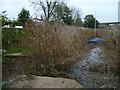
Orange Way in Devon and Torbay (275)
There is a footbridge in the reed bed and the walk approaches the M5 bridge.
Image: © Shazz
Taken: 19 Nov 2011
0.07 miles
3
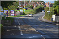
Cycle Route on Topsham Road, Exeter
A segregated cycle track and footway besides Topsham Road in Exeter. The give way markings of a side road have been set back from the edge of the main carriageway. A pragmatic solution to ensure cyclists using the cycle track have priority over traffic using the side road.
Image: © Andrew Tryon
Taken: 1 Oct 2019
0.08 miles
5

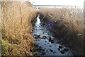
Homes in Newport Park and reed beds
The reed beds border the River Exe. A public footpath runs through them, linking Topsham and Countess Wear
Image: © David Smith
Taken: 2 Sep 2011
0.08 miles
6
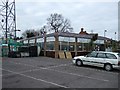
Seabrook Garden Centre
Garden Centre shop and car park
Image: © David Smith
Taken: 23 Dec 2005
0.08 miles
7

Newport Lodge
Classified by Exeter as a Building of Local Importance, but not listed. However, Alan Rosevear has given a detailed description at http://www.flickr.com/photos/tollhouses/3121030946/ , which comments: "The principal structure is thought to have been built for the Exeter Turnpike Trust in 1841 in the form of a lodge house with angular front."
On the left is the main road to Exeter from Topsham. Overhead is a rainbow.
Image: © Derek Harper
Taken: 4 Nov 2009
0.08 miles


10
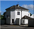
Former Toll House at Loggershead Gate
Toll House in the parish of Exeter (Exeter District), now Newport Lodge, Exeter Road, Topsham, EX2 7DR. The principal structure is thought to have been built for the Exeter Turnpike Trust in 1841 in the form of a lodge house with angular front.
Devon & Dartmoor HER.
HER Number: MDV9937 https://www.heritagegateway.org.uk/Gateway/Results_Single.aspx?uid=MDV9937&resourceID=104
Surveyed
Milestone Society National ID: DV.EXE01
Image: © Alan Rosevear
Taken: Unknown
0.09 miles