
IMAGES TAKEN NEAR TO
Franklin Street, EXETER, EX2 4HF
Introduction
This page details the photographs taken nearby to Franklin Street, EX2 4HF by members of the Geograph project.
The Geograph project started in 2005 with the aim of publishing, organising and preserving representative images for every square kilometre of Great Britain, Ireland and the Isle of Man.

There are currently over 7.5m images from over14,400 individuals and you can help contribute to the project by visiting https://www.geograph.org.uk
Image Map
Images are licensed for reuse under creativecommons.org/licenses/by-sa/2.0
Notes
- Clicking on the map will re-center to the selected point.
- The higher the marker number, the further away the image location is from the centre of the postcode.
Image Listing (671 Images Found)
Images are licensed for reuse under creativecommons.org/licenses/by-sa/2.0
Image
Details
Distance
1

Franklin Street, Exeter
The terraced houses are on the slope of a valley which provided a natural defence for the walled city of Exeter.
Image: © David Smith
Taken: 29 Mar 2020
0.01 miles
2
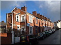
Franklin Street, Exeter
One of a network of Victorian streets of terraces around the Larkbeare valley off Holloway Street.
Image: © Derek Harper
Taken: 21 Nov 2006
0.01 miles
4

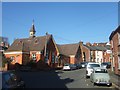
Junction of Franklin Street and Radford Road, Exeter
Part of an area of terraced houses; the end of the terrace has been given two blind windows
Image: © David Smith
Taken: 29 Mar 2020
0.02 miles
5
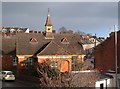
St Leonard's church hall, Exeter
At the junction of Temple Road (left) with Roberts Road (terrace climbing hill to right), with a little bell turret.
Image: © Derek Harper
Taken: 21 Nov 2006
0.03 miles
6
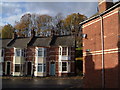
Temple Road, Exeter
Clouds threaten the autumn sunshine at the junction of Dean Street with Temple Road; there is a glimpse of Bull Meadow on the right.
Image: © Derek Harper
Taken: 21 Nov 2006
0.03 miles
7

Radford Road, Exeter
Stepped Victorian terraces climb away from Roberts Road towards Mount Radford.
Image: © Derek Harper
Taken: 21 Nov 2006
0.03 miles
8

St Leonards Church Hall, South elevation
Looking up Roberts Road with Temple Road to the west.
Image: © Peter Holmes
Taken: 12 Dec 2007
0.03 miles
9
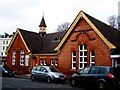
St .Leonards Church pre- school
A most evocative building, at a glance transporting one to the past. It nestles at the bottom of Roberts road at the junction with Temple road, St. Leonards.
Image: © Jan Baker
Taken: 29 Nov 2008
0.05 miles
10
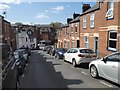
Looking down Radford Road to Roberts Road, Exeter
The terraced houses are on the slope of a valley; beyond the foot of the valley, the further slope leads to the city wall of Exeter, and the valley provided a natural defence for the walled city. The stream is now culverted.
Image: © David Smith
Taken: 29 Mar 2020
0.05 miles