
IMAGES TAKEN NEAR TO
Mount Radford Crescent, EXETER, EX2 4EN
Introduction
This page details the photographs taken nearby to Mount Radford Crescent, EX2 4EN by members of the Geograph project.
The Geograph project started in 2005 with the aim of publishing, organising and preserving representative images for every square kilometre of Great Britain, Ireland and the Isle of Man.

There are currently over 7.5m images from over14,400 individuals and you can help contribute to the project by visiting https://www.geograph.org.uk
Image Map
Images are licensed for reuse under creativecommons.org/licenses/by-sa/2.0
Notes
- Clicking on the map will re-center to the selected point.
- The higher the marker number, the further away the image location is from the centre of the postcode.
Image Listing (530 Images Found)
Images are licensed for reuse under creativecommons.org/licenses/by-sa/2.0
Image
Details
Distance
1

House on Mount Radford Crescent, Exeter
One of 5 elegant C19 houses on this circus-like crescent facing Image across a circular tree-lined lawn.
Image: © Derek Harper
Taken: 10 Jan 2007
0.01 miles
2
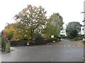
Mount Radford Crescent, Exeter
A small private garden surrounded by the loop of Mount Radford Crescent and the 19th century houses.
Image: © David Smith
Taken: 3 Nov 2019
0.04 miles
3

Cedar tree in garden, Mount Radford Crescent, Exeter
The crescent has a central garden. The five surviving houses date from the 19th century and are listed grade II https://www.britishlistedbuildings.co.uk/101267674-1-5-mount-radford-crescent-exeter#.WmJWVTfLiUk
Image: © David Smith
Taken: 19 Jan 2018
0.04 miles
4

Ernesborough Court, St Leonard's, Exeter
A large house now divided into small flats
Image: © David Smith
Taken: 1 Jan 2020
0.04 miles
5

Crescent Mansions, Exeter
A mid-20th century block of flats on Mount Radford Crescent
Image: © David Smith
Taken: 29 Mar 2020
0.04 miles
6
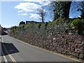
Stone retaining wall, Crescent Mansions, Exeter
Mostly built of the local Pocombe stone Image with some Heavitree stone (sandstone) and material from a few other local quarries. The apartment block can be seen beyond the wall
Image: © David Smith
Taken: 29 Mar 2020
0.04 miles
7
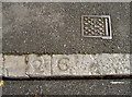
Pavement numbers
This appears to be a distance measurement (2ft 6?) but to what? See Image] for a wider view.
Image: © Neil Owen
Taken: 20 Aug 2014
0.05 miles
8
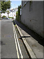
Radford Road
Looking up towards the crescent, there is a section of kerbing here that has numbers carved into it. See Image] for a closer look.
Image: © Neil Owen
Taken: 20 Aug 2014
0.05 miles
10
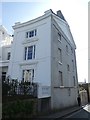
The western end of The Quadrant, Exeter
One end of a Victorian row of six houses forming a quadrant. In the foreground, the iron railings survived the recycling drives of WW2
Image: © David Smith
Taken: 29 Mar 2020
0.05 miles