
IMAGES TAKEN NEAR TO
Pinch Hill, BUDE, EX23 0ER
Introduction
This page details the photographs taken nearby to Pinch Hill, EX23 0ER by members of the Geograph project.
The Geograph project started in 2005 with the aim of publishing, organising and preserving representative images for every square kilometre of Great Britain, Ireland and the Isle of Man.

There are currently over 7.5m images from over14,400 individuals and you can help contribute to the project by visiting https://www.geograph.org.uk
Image Map
Images are licensed for reuse under creativecommons.org/licenses/by-sa/2.0
Notes
- Clicking on the map will re-center to the selected point.
- The higher the marker number, the further away the image location is from the centre of the postcode.
Image Listing (45 Images Found)
Images are licensed for reuse under creativecommons.org/licenses/by-sa/2.0
Image
Details
Distance
1
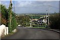
Pinch Hill, Marhamchurch
Looking north out of the village and down into the valley.
Image: © Tony Atkin
Taken: 10 Oct 2009
0.03 miles

3

Site of the former Bude Canal at Marhamchurch, 1976
The dry bed of the canal is clearly marked on the 6th edition OS map of 1949, and is shown here heading east. The photograph was taken where the canal went under the road that leads north out of Marhamchurch. Later map series show the canal route as a track or path. The stone to the right of the gate is part of a former canal bridge.
Image: © Crispin Purdye
Taken: Unknown
0.09 miles
4

Pinch Hill
Leading away from the gateway where Image] was taken.
Image: © Derek Harper
Taken: 21 Jun 2019
0.10 miles
6
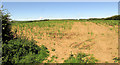
Maize near Marhamchurch
On the north side of the village, with sheep grazing further off.
Image: © Derek Harper
Taken: 21 Jun 2019
0.12 miles
7
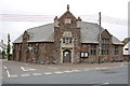
"The Bray" Church of England Institute, Marhamchurch
Image: © Julian P Guffogg
Taken: 3 Aug 2009
0.13 miles
8
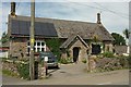
Former National School, Marhamchurch
Bearing the date 1873 on the lintel.
Image: © Derek Harper
Taken: 31 May 2016
0.14 miles
9
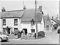
Cottages on the corner, Marhamchurch, 1966
On the corner of Helebridge Road and Pinch Hill (on the right).
Image: © Robin Webster
Taken: Unknown
0.14 miles
10

The top of Pinch Hill
Where it enters Helebridge Road.
Image: © John Baker
Taken: 24 Mar 2013
0.14 miles