
IMAGES TAKEN NEAR TO
Bridgerule, HOLSWORTHY, EX22 7EL
Introduction
This page details the photographs taken nearby to EX22 7EL by members of the Geograph project.
The Geograph project started in 2005 with the aim of publishing, organising and preserving representative images for every square kilometre of Great Britain, Ireland and the Isle of Man.

There are currently over 7.5m images from over14,400 individuals and you can help contribute to the project by visiting https://www.geograph.org.uk
Image Map
Images are licensed for reuse under creativecommons.org/licenses/by-sa/2.0
Notes
- Clicking on the map will re-center to the selected point.
- The higher the marker number, the further away the image location is from the centre of the postcode.
Image Listing (11 Images Found)
Images are licensed for reuse under creativecommons.org/licenses/by-sa/2.0
Image
Details
Distance
1
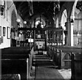
Interior of St Bridget's Church, Bridgerule
A vintage view. The church retains many fittings installed between 1889 and 1907 (including the rood screen, organ case, reredos and lamps) and though these are mass-produced and not of a high aesthetic standard they are interesting as a survival of Tractarian taste.
Image: © Sinclair Aytoun
Taken: Unknown
0.01 miles
2
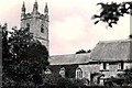
St Bridget's Church and Church Cottage
As in many Devon and Cornish parishes the Church Town at Bridgerule, comprising the ancient church and a few nearby houses, stands some distance outside the village. This historic photograph was taken by the grandson of the Revd Frank Hawker Kingdon who was Vicar of the parish for seventy years from 1888-1958.
Image: © Sinclair Aytoun
Taken: Unknown
0.03 miles
3
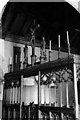
Rood screen in St Bridget's Church
The screen with its rood and six candles is contemporary with the other Tractarian furnishings in the church and dates from the last decade of the 19th century.
Image: © Sinclair Aytoun
Taken: Unknown
0.03 miles
4
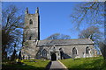
St Bridget's church, Churchtown
The church dates from the 13th century.
Image: © Julian P Guffogg
Taken: 14 Mar 2016
0.03 miles
5
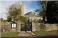
St Bridget's Church
http://genuki.cs.ncl.ac.uk/DEV/Bridgerule/index.html
Image: © Paul McIlroy
Taken: 1 Oct 2006
0.03 miles
6
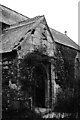
South Porch of St Bridget's Church, 1945
The porch dates from the first half of the 15th century, when the south transept of the church was extended westwards to form an aisle. Above the entrance is an effigy of a man with a book, probably representing St Michael, above a niche containing a sundial of around 1800. The porch contains the Georgian slate Decalogue tablets which were removed from the chancel in the late 19th-century restorations and a late Norman pillar piscina which now serves as a holy water stoup.
Image: © Sinclair Aytoun
Taken: Unknown
0.03 miles
7
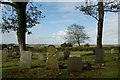
St Bridget's Churchyard
A view southwest.
Image: © Paul McIlroy
Taken: 1 Oct 2006
0.11 miles
8
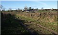
Track from Furze Cross
The track is signed as unsuitable for motor vehicles. It links the lanes at Furze Cross to Churchtown, Bridgerule across a little valley, and St Bridget's Church can be seen in the background.
Image: © Derek Harper
Taken: 4 Mar 2008
0.20 miles
9
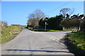
Furze Cross, near Bridgerule
North Tamerton to the right.
Most of the lanes in this area are unnamed.
Image: © J.Hannan-Briggs
Taken: 14 Mar 2016
0.24 miles
10
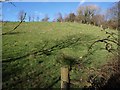
Field near Bridgerule
Leaning across the gate by the road east of Bridgerule leading up to Churchtown, with the shadow of a tree falling across this steep field on the slopes of a tributary of the nearby Tamar. The trees on the right are on the edge of a disused quarry.
Image: © Derek Harper
Taken: 4 Mar 2008
0.25 miles