IMAGES TAKEN NEAR TO
Chilsworthy, HOLSWORTHY, EX22 7BJ
Introduction
This page details the photographs taken nearby to EX22 7BJ by members of the Geograph project.
The Geograph project started in 2005 with the aim of publishing, organising and preserving representative images for every square kilometre of Great Britain, Ireland and the Isle of Man.

There are currently over 7.5m images from over14,400 individuals and you can help contribute to the project by visiting https://www.geograph.org.uk
Image Map
Images are licensed for reuse under creativecommons.org/licenses/by-sa/2.0
Notes
- Clicking on the map will re-center to the selected point.
- The higher the marker number, the further away the image location is from the centre of the postcode.
Image Listing (6 Images Found)
Images are licensed for reuse under creativecommons.org/licenses/by-sa/2.0
Image
Details
Distance
1
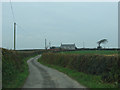
Windswept Country Cottage
Looking north north-west
Image: © Robert Walden
Taken: 26 Oct 2007
0.02 miles
2
Towards East Vognacott
From the same spot as Image], looking left.
Image: © Derek Harper
Taken: 23 Apr 2016
0.09 miles
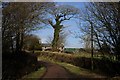
3
Holepark
The lane from Vognacott approaches the farm at Holepark.
Image: © Derek Harper
Taken: 23 Apr 2016
0.17 miles
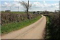
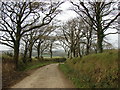
4
The Road Past Holepark
A narrow country lane.
Image: © Tony Atkin
Taken: 17 Jan 2010
0.18 miles
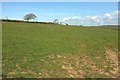
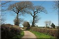
5
Country lane
The trees have been slowly sculpted by the wind into some fine shapes.
Image: © Robert Walden
Taken: 26 Oct 2007
0.19 miles
6
Lane at Babbington
With the farm at Holepark in the background.
Image: © Derek Harper
Taken: 23 Apr 2016
0.20 miles