
IMAGES TAKEN NEAR TO
Broad Close, HOLSWORTHY, EX22 6UW
Introduction
This page details the photographs taken nearby to Broad Close, EX22 6UW by members of the Geograph project.
The Geograph project started in 2005 with the aim of publishing, organising and preserving representative images for every square kilometre of Great Britain, Ireland and the Isle of Man.

There are currently over 7.5m images from over14,400 individuals and you can help contribute to the project by visiting https://www.geograph.org.uk
Image Map
Images are licensed for reuse under creativecommons.org/licenses/by-sa/2.0
Notes
- Clicking on the map will re-center to the selected point.
- The higher the marker number, the further away the image location is from the centre of the postcode.
Image Listing (10 Images Found)
Images are licensed for reuse under creativecommons.org/licenses/by-sa/2.0
Image
Details
Distance
1

Ordnance Survey Flush Bracket 1677
This can be found on the wall of a house - private dwelling - at Week Green.
For more detail see : http://www.bench-marks.org.uk/bm43
Image: © Peter Wood
Taken: 31 Mar 2015
0.03 miles
2
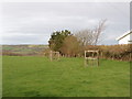
Field and young trees south of Week Green
The house just in the photo is the last in the village of Week Green. View from the road.
Image: © David Hawgood
Taken: 27 Feb 2008
0.05 miles
3
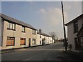
Houses at Week Green
Looking in the opposite direction from the same spot as Image], down the road to Launceston.
Image: © Derek Harper
Taken: 18 Mar 2015
0.05 miles
4
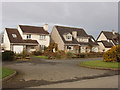
Houses in Week Green
A close off the road to the Langdons.
Image: © David Hawgood
Taken: 27 Feb 2008
0.05 miles
5

Houses at Week Green
Week Green is the southern part of Week St Mary. This road has arrived from Broad Langdon.
Image: © Derek Harper
Taken: 18 Mar 2015
0.07 miles
6
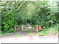
Week Green
Entrance to a footpath/cycleway with a sign for every possible user.
Image: © Neil Lewin
Taken: 10 Jul 2006
0.07 miles
7
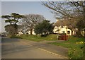
Houses at Week Green
A terrace of six houses set back a little from the main road through the village.
Image: © Derek Harper
Taken: 18 Mar 2015
0.07 miles
8
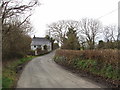
Road south of Week Green
This is the road to the Langdons - part of National Cycle Route 3. There is an earth bank one side, close to the road, with a hedge on top - typical of minor roads in the area. The house in the photo is right up against the road, with no front garden.
Image: © David Hawgood
Taken: 27 Feb 2008
0.12 miles
9
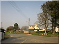
Week Green
The main road through the village, with, in the foreground, the junction with the road shown in Image
Image: © Derek Harper
Taken: 18 Mar 2015
0.12 miles
10

Ordnance Survey Flush Bracket 1676
This can be found on the wall of a building at Reeve House.
For more detail see : http://www.bench-marks.org.uk/bm10471
Image: © Peter Wood
Taken: 31 Mar 2015
0.23 miles