
IMAGES TAKEN NEAR TO
Whitstone, HOLSWORTHY, EX22 6UD
Introduction
This page details the photographs taken nearby to EX22 6UD by members of the Geograph project.
The Geograph project started in 2005 with the aim of publishing, organising and preserving representative images for every square kilometre of Great Britain, Ireland and the Isle of Man.

There are currently over 7.5m images from over14,400 individuals and you can help contribute to the project by visiting https://www.geograph.org.uk
Image Map
Images are licensed for reuse under creativecommons.org/licenses/by-sa/2.0
Notes
- Clicking on the map will re-center to the selected point.
- The higher the marker number, the further away the image location is from the centre of the postcode.
Image Listing (13 Images Found)
Images are licensed for reuse under creativecommons.org/licenses/by-sa/2.0
Image
Details
Distance
1
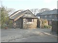
Willow Cottage
One of the cottages one can rent from Bennetts Court Holiday Cottages. Willow Cottage was a former barn and was my accommodation from 23-30/03/13. The house known as Bennetts Court is that to the right http://www.bennettscourt.co.uk/Cottages.php
Image: © John Baker
Taken: 26 Mar 2013
0.01 miles
2
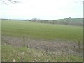
Looking north from the grounds of Bennetts Court
Image: © John Baker
Taken: 29 Mar 2013
0.03 miles
3

Three of Bennetts Court Holiday Cottages
Bluebell, Primrose and Foxglove (from nearest to furthest, respectively). I was standing with Image to my right.
Image: © John Baker
Taken: 26 Mar 2013
0.03 miles
4
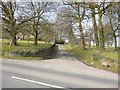
Entrance to Bennetts Court Holiday Cottages
From the B3254. I stayed in Image and found the cottage to be very well equipped, comfortable and cosy.
Image: © John Baker
Taken: 26 Mar 2013
0.04 miles
5
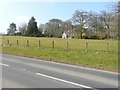
The house known as Bennetts
Seen from the B3254.
Image: © John Baker
Taken: 26 Mar 2013
0.04 miles
6

Northwest view from Bennetts Court grounds
The sea is just visible on the horizon. It was the last opportunity I had to take the view before leaving for home.
Image: © John Baker
Taken: 30 Mar 2013
0.05 miles
7
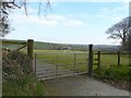
North-northeast view over Bennetts Court sports field
With the turbines on Thorne Farm just visible to the right of the B3254.
Image: © John Baker
Taken: 29 Mar 2013
0.05 miles
8
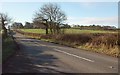
B3254 south of Bennetts Yard
The B road between Launceston and Kilkhampton is in effect crossing a small col between the watersheds of the Tamar (left), flowing to the English Channel to the south, and the Neet, draining into Bude Bay to the west. Image] looks in the opposite direction.
Image: © Derek Harper
Taken: 19 Jan 2017
0.18 miles
10

Old Milestone by the B3254, Whitstone
Carved stone post by the B3254, in parish of WHITSTONE (NORTH CORNWALL District), Whitstone village, on East side of road. Kilkhampton County stone, erected by the Local Highways Board in the 19th century.
Inscription reads:-
LAUNCESTON
10
KILKHAMPTON
9
BUDE
(9)
Cornwall & Scilly HER.
HER Number: 176716 https://www.heritagegateway.org.uk/Gateway/Results_Single.aspx?uid=MCO52527&resourceID=1020
Milestone Society National ID: CW_KHLA09
Image: © Ian Thompson
Taken: Unknown
0.21 miles