
IMAGES TAKEN NEAR TO
Derril, HOLSWORTHY, EX22 6LW
Introduction
This page details the photographs taken nearby to Derril, EX22 6LW by members of the Geograph project.
The Geograph project started in 2005 with the aim of publishing, organising and preserving representative images for every square kilometre of Great Britain, Ireland and the Isle of Man.

There are currently over 7.5m images from over14,400 individuals and you can help contribute to the project by visiting https://www.geograph.org.uk
Image Map
Images are licensed for reuse under creativecommons.org/licenses/by-sa/2.0
Notes
- Clicking on the map will re-center to the selected point.
- The higher the marker number, the further away the image location is from the centre of the postcode.
Image Listing (12 Images Found)
Images are licensed for reuse under creativecommons.org/licenses/by-sa/2.0
Image
Details
Distance
1

Road out of Derril
Looking in the opposite direction from the same spot as Image], with more bungalows on the right.
Image: © Derek Harper
Taken: 23 Apr 2016
0.09 miles
2
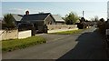
Derril
The road from Killatree Cross entering the village. The bungalow on the left seems to have been substantially rebuilt in recent years.
Image: © Derek Harper
Taken: 23 Apr 2016
0.13 miles
6

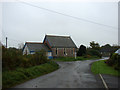
Lane to Derril
The lane from Hillsborough Cross, about half way to Derril.
Image: © Derek Harper
Taken: 23 Apr 2016
0.18 miles
7

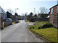
Lane to Derril
Image: © Derek Harper
Taken: 23 Apr 2016
0.19 miles
8

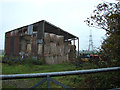
Remains of Bude Branch Railway Bridge
The bridge once carried the Holsworthy to Bude Branch Line which closed in 1966.
Image: © Guy Wareham
Taken: 12 Jun 2016
0.20 miles
9

Towards Pyworthy
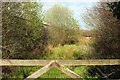
The view from the stile shown in Image], roughly long the line of Pyworthy Footpath 12. Pyworthy is on the next ridge.
Image: © Derek Harper
Taken: 23 Apr 2016
0.20 miles
10
Barn and field north of Derril
From the same point as Image], looking left. An unnamed wood borders the glimpsed field on the far side; its northern border is Derril Water.
Image: © Derek Harper
Taken: 23 Apr 2016
0.21 miles