
IMAGES TAKEN NEAR TO
Glovers Close, HOLSWORTHY, EX22 6EU
Introduction
This page details the photographs taken nearby to Glovers Close, EX22 6EU by members of the Geograph project.
The Geograph project started in 2005 with the aim of publishing, organising and preserving representative images for every square kilometre of Great Britain, Ireland and the Isle of Man.

There are currently over 7.5m images from over14,400 individuals and you can help contribute to the project by visiting https://www.geograph.org.uk
Image Map
Images are licensed for reuse under creativecommons.org/licenses/by-sa/2.0
Notes
- Clicking on the map will re-center to the selected point.
- The higher the marker number, the further away the image location is from the centre of the postcode.
Image Listing (63 Images Found)
Images are licensed for reuse under creativecommons.org/licenses/by-sa/2.0
Image
Details
Distance
1

The Hats Theatre, Bodmin Street, Holsworthy
This was built as a cinema in 1932, but was closed eventually and became a warehouse for a while before being refurbished as a theatre. (Information from the town trail booklet)
Image: © Humphrey Bolton
Taken: 6 Apr 2010
0.03 miles
2

HATS Theatre Holsworthy
This art deco former cinema has been saved by recladding the main building to provide a home for the thriving Holsworthy Amateur Theatre Society. A magnificent pantomime is performed each year.
Image: © Robert Walden
Taken: 27 Oct 2007
0.05 miles
3

Holsworthy station (remains), 1995
View eastward, towards Halwill Junction: ex-LSWR Bude branch from Halwill Junction on the Exeter - Okehampton - Padstow/Plymouth lines, closed 3/10/66.
Image: © Ben Brooksbank
Taken: 24 Apr 1995
0.09 miles
4

Traffic lights beside Derriton Viaduct
Here it is probable that the road passed under a bridge for there is an abutment on the right hand side. Traffic-calming measures, through the installation of traffic lights, seem to have been put in place by making the road only wide enough for vehicles in one direction at a time.
Image: © John Baker
Taken: 25 Mar 2013
0.10 miles
5
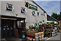
Holsworthy : Mole Valley Farmers
Looking towards the Holsworthy branch of Mole Valley Farmers.
Image: © Lewis Clarke
Taken: 17 Jul 2014
0.10 miles
6

Holsworthy : Mole Valley Farmers
Looking towards the Mole Valley Farmers branch in Holsworthy.
Image: © Lewis Clarke
Taken: 17 Jul 2014
0.10 miles
7
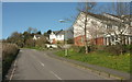
Woodland View, Holsworthy
The main road is, I think, Bodmin Street, even though it has left the built-up area of the town.
Image: © Derek Harper
Taken: 23 Apr 2016
0.11 miles
9

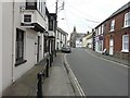
Car park, Holsworthy
The Waitrose car park. This is the former site of Holsworthy station.
Image: © Derek Harper
Taken: 12 Aug 2013
0.12 miles
10
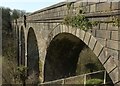
Derriton Viaduct
The same view as Image and Image The sun picks out the "early use of shuttered concrete construction for bridges, simulating masonry in a most convincing manner" https://www.historicengland.org.uk/listing/the-list/list-entry/1317898 on this grade II* listed structure. The date is 1898, and the line of the former Holsworthy to Bude railway across the viaduct is now followed by cycle route NCN3, but alas for only just over a kilometre westwards. Below is the valley of the River Deer.
Image: © Derek Harper
Taken: 23 Apr 2016
0.12 miles