IMAGES TAKEN NEAR TO
Shebbear, BEAWORTHY, EX21 5RA
Introduction
This page details the photographs taken nearby to EX21 5RA by members of the Geograph project.
The Geograph project started in 2005 with the aim of publishing, organising and preserving representative images for every square kilometre of Great Britain, Ireland and the Isle of Man.

There are currently over 7.5m images from over14,400 individuals and you can help contribute to the project by visiting https://www.geograph.org.uk
Image Map
Images are licensed for reuse under creativecommons.org/licenses/by-sa/2.0
Notes
- Clicking on the map will re-center to the selected point.
- The higher the marker number, the further away the image location is from the centre of the postcode.
Image Listing (10 Images Found)
Images are licensed for reuse under creativecommons.org/licenses/by-sa/2.0
Image
Details
Distance
1
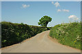
Lane from Berry Cross
Leading to North Furze.
Image: © Derek Harper
Taken: 23 May 2018
0.09 miles
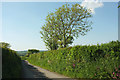
2
Lane near Manna Park
Heading towards the farming hamlet of Berry, and seen from the same spot as Image
Image: © Derek Harper
Taken: 23 May 2018
0.09 miles
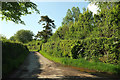
3
Lane to Caute
From Berry Cross, looking to the left from Image
Image: © Derek Harper
Taken: 23 May 2018
0.11 miles
4

View at the Berry Triangulation Pillar
Looking north-westward. Seems to be more foundation than pillar.
Image: © Peter Wood
Taken: 2 Apr 2015
0.11 miles
5
Manna Park
At some stage the name has changed from Manorpark, which is what appears on the current 1:25000 map, to Manna Park, which is shown on larger scale maps. Shebbear footpath 9 follows the track to it.
Image: © Derek Harper
Taken: 23 May 2018
0.11 miles
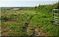
6

Footpath to Manna Park
A view along the track shown in Image], and used by Shebbear footpath 9.
Image: © Derek Harper
Taken: 23 May 2018
0.11 miles
7
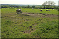
Sheep at Berry Cross
Looking behind the camera in Image], just north of Berry Farm.
Image: © Derek Harper
Taken: 23 May 2018
0.15 miles
8
Field near Pennicknold
Looking left from where Image was taken.
Image: © Derek Harper
Taken: 23 May 2018
0.24 miles
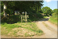
9

Field entrance near Higher Park
From the lane from Shebbear to Caute at the same spot as Image
Image: © Derek Harper
Taken: 23 May 2018
0.24 miles
10

Lane to Ruxhill
The lane from Shebbear to Caute approaching Higher Park.
Image: © Derek Harper
Taken: 23 May 2018
0.25 miles