
IMAGES TAKEN NEAR TO
Highampton, BEAWORTHY, EX21 5JJ
Introduction
This page details the photographs taken nearby to EX21 5JJ by members of the Geograph project.
The Geograph project started in 2005 with the aim of publishing, organising and preserving representative images for every square kilometre of Great Britain, Ireland and the Isle of Man.

There are currently over 7.5m images from over14,400 individuals and you can help contribute to the project by visiting https://www.geograph.org.uk
Image Map
Images are licensed for reuse under creativecommons.org/licenses/by-sa/2.0
Notes
- Clicking on the map will re-center to the selected point.
- The higher the marker number, the further away the image location is from the centre of the postcode.
Image Listing (5 Images Found)
Images are licensed for reuse under creativecommons.org/licenses/by-sa/2.0
Image
Details
Distance
1

Evergreen trees by A3072 near Beara Court
The gateway to the Beara Court grounds is by the tall tree on the right; presumably these were trees planted to enhance the land of the Court
Image: © David Smith
Taken: 14 Apr 2016
0.14 miles
2
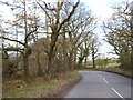
A3072 passing Park Plantation
Park Plantation is bounded to the north and east by the A3072; on the edge of the woodland to the left is a deep ditch, reminder of the moorland that needed to be drained
Image: © David Smith
Taken: 14 Apr 2016
0.16 miles
3
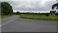
Torridge : The A3072
At a road junction on the A3072.
Image: © Lewis Clarke
Taken: 27 Jun 2017
0.20 miles

5
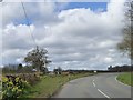
Beara Cross
A road junction which has been realigned for safety. Formerly, the road ahead ran in a straight line from the main road, but now joining traffic is forced to slow down or stop
Image: © David Smith
Taken: 14 Apr 2016
0.21 miles