
IMAGES TAKEN NEAR TO
Lewdown, OKEHAMPTON, EX20 4NX
Introduction
This page details the photographs taken nearby to EX20 4NX by members of the Geograph project.
The Geograph project started in 2005 with the aim of publishing, organising and preserving representative images for every square kilometre of Great Britain, Ireland and the Isle of Man.

There are currently over 7.5m images from over14,400 individuals and you can help contribute to the project by visiting https://www.geograph.org.uk
Image Map
Images are licensed for reuse under creativecommons.org/licenses/by-sa/2.0
Notes
- Clicking on the map will re-center to the selected point.
- The higher the marker number, the further away the image location is from the centre of the postcode.
Image Listing (36 Images Found)
Images are licensed for reuse under creativecommons.org/licenses/by-sa/2.0
Image
Details
Distance
1
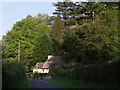
Lew Cottage
A thatched cottage on the no through lane from Lew Quarry Farm towards Lewtrenchard.
Image: © Derek Harper
Taken: 1 May 2007
0.01 miles
2
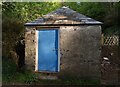
Shed at Lew Quarry
A little outhouse near the lane shown in Image
Image: © Derek Harper
Taken: 1 May 2007
0.03 miles
3
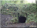
Lime kiln near Lew Quarry
One of a series of disused lime kilns near Lew Quarry Cottage.
Image: © Derek Harper
Taken: 1 May 2007
0.05 miles
4
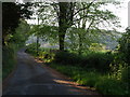
Lane to Lewquarry Farm
This is a no through road leading off Image, and winding round a hill towards the River Lew.
Image: © Derek Harper
Taken: 1 May 2007
0.07 miles
5
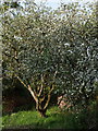
Blossom near Lew Quarry
An apple tree on the southern side of the no through lane past Lew Quarry Cottage.
Image: © Derek Harper
Taken: 1 May 2007
0.07 miles
6
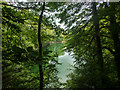
A flooded quarry
On the map, this looks as if it's an ornamental lake in the grounds of the hotel. Far from it. It's an old quarry (Lew Quarry), well fenced off. I tried to look up some information on the internet, but couldn't get past the adverts for the various self-catering cottages in the vicinity.
Image: © Neville Goodman
Taken: 2 Aug 2020
0.09 miles
7
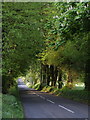
Road south of Lewtrenchard
The tree-lined road runs straight to intercept the River Lew some 650 metres away.
Image: © Derek Harper
Taken: 1 May 2007
0.10 miles
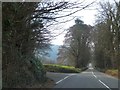
9
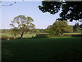
Fields near Lewtrenchard
A view to the right from the straight road shown in Image across farmland in the direction of Coombe Trenchard.
Image: © Derek Harper
Taken: 1 May 2007
0.14 miles
10
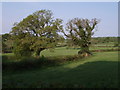
Hedge and trees near Lewtrenchard
Image: © Derek Harper
Taken: 1 May 2007
0.14 miles