IMAGES TAKEN NEAR TO
Bridestowe, OKEHAMPTON, EX20 4HZ
Introduction
This page details the photographs taken nearby to EX20 4HZ by members of the Geograph project.
The Geograph project started in 2005 with the aim of publishing, organising and preserving representative images for every square kilometre of Great Britain, Ireland and the Isle of Man.

There are currently over 7.5m images from over14,400 individuals and you can help contribute to the project by visiting https://www.geograph.org.uk
Image Map
Images are licensed for reuse under creativecommons.org/licenses/by-sa/2.0
Notes
- Clicking on the map will re-center to the selected point.
- The higher the marker number, the further away the image location is from the centre of the postcode.
Image Listing (5 Images Found)
Images are licensed for reuse under creativecommons.org/licenses/by-sa/2.0
Image
Details
Distance
1
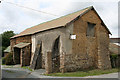
Sourton: Week Farm
A barn by the entrance displaying three building materials – stone, cob and corrugated iron. With buttresses. Week is listed on the Devon Farms website – see http://www.devonfarms.co.uk/ and offers bed and breakfast, self catering cottages and coarse fishing. Looking west-south-west
Image: © Martin Bodman
Taken: 8 Jul 2006
0.03 miles
2
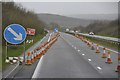
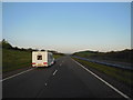
West Devon : The A30
The A30 with some roadworks and cones in the road.
Image: © Lewis Clarke
Taken: 23 Feb 2014
0.13 miles
3
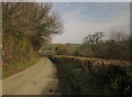
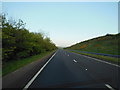
Lane to Week Farm
Descending a small tributary valley of the Thrushel.
Image: © Derek Harper
Taken: 2 Mar 2012
0.19 miles