
IMAGES TAKEN NEAR TO
Lobhill Cross, OKEHAMPTON, EX20 4DU
Introduction
This page details the photographs taken nearby to Lobhill Cross, EX20 4DU by members of the Geograph project.
The Geograph project started in 2005 with the aim of publishing, organising and preserving representative images for every square kilometre of Great Britain, Ireland and the Isle of Man.

There are currently over 7.5m images from over14,400 individuals and you can help contribute to the project by visiting https://www.geograph.org.uk
Image Map
Images are licensed for reuse under creativecommons.org/licenses/by-sa/2.0
Notes
- Clicking on the map will re-center to the selected point.
- The higher the marker number, the further away the image location is from the centre of the postcode.
Image Listing (3 Images Found)
Images are licensed for reuse under creativecommons.org/licenses/by-sa/2.0
Image
Details
Distance
1

Old Milestone near Lobhill Cross, Thrushelton
Carved stone post by the UC road (was A30), in parish of THRUSHELTON (WEST DEVON District), just East of Lobhill Cross, 50m up (West) from Lobhill Lodge, in hedge bank, on North side of road. Launceston gable, erected by the Launceston turnpike trust in the 19th century.
Inscription reads:- : LAUNCESTON / 9 / OKEHAMPTON 9½ :
Milestone Society National ID: DV_LAOK09.
Image: © A Rosevear
Taken: 1 Mar 2013
0.14 miles
2
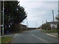
Lobhillcross crossroads
On the old A30 just west of Lobhill (spelt on the OS map as one word)
Image: © David Smith
Taken: 26 Mar 2013
0.14 miles
3

Old Boundary Marker by Lobhillcross, Lewtrenchard parish
Parish Boundary Marker by the UC road (was A30), in parish of Lewtrenchard (West Devon District), Lobhillcross, 50m West of Lobhill lodge, on grass verge/bank above path by fence.
Devon & Dartmoor HER.
HER Number: MDV59500 https://www.heritagegateway.org.uk/Gateway/Results_Single.aspx?uid=MDV59500&resourceID=104
Carved benchmark on lower East face.
Surveyed
Milestone Society National ID: DV_LAEX07pb
Image: © Alan Rosevear
Taken: 27 Feb 2012
0.15 miles