IMAGES TAKEN NEAR TO
Barn Park View, OKEHAMPTON, EX20 4DH
Introduction
This page details the photographs taken nearby to Barn Park View, EX20 4DH by members of the Geograph project.
The Geograph project started in 2005 with the aim of publishing, organising and preserving representative images for every square kilometre of Great Britain, Ireland and the Isle of Man.

There are currently over 7.5m images from over14,400 individuals and you can help contribute to the project by visiting https://www.geograph.org.uk
Image Map
Images are licensed for reuse under creativecommons.org/licenses/by-sa/2.0
Notes
- Clicking on the map will re-center to the selected point.
- The higher the marker number, the further away the image location is from the centre of the postcode.
Image Listing (4 Images Found)
Images are licensed for reuse under creativecommons.org/licenses/by-sa/2.0
Image
Details
Distance
2
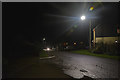
Lewdown : The Redcliffes
A road heading into Lewdown.
Image: © Lewis Clarke
Taken: 26 Nov 2017
0.14 miles
3
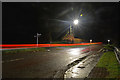
Lewdown : The Redcliffes
A road heading out from Lewdown.
Image: © Lewis Clarke
Taken: 26 Nov 2017
0.15 miles
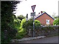
4
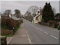
Lewdown
Looking west along the former A30 through the village of Lewdown, following a ridge between the valleys of the Thrushel and the Lew. New bungalows have appeared (left of the camera); the old A30 is quieter to live on but also still a fast link to nearby towns.
Image: © Derek Harper
Taken: 17 Mar 2007
0.16 miles