IMAGES TAKEN NEAR TO
Jacobstowe, OKEHAMPTON, EX20 3RJ
Introduction
This page details the photographs taken nearby to EX20 3RJ by members of the Geograph project.
The Geograph project started in 2005 with the aim of publishing, organising and preserving representative images for every square kilometre of Great Britain, Ireland and the Isle of Man.

There are currently over 7.5m images from over14,400 individuals and you can help contribute to the project by visiting https://www.geograph.org.uk
Image Map
Images are licensed for reuse under creativecommons.org/licenses/by-sa/2.0
Notes
- Clicking on the map will re-center to the selected point.
- The higher the marker number, the further away the image location is from the centre of the postcode.
Image Listing (11 Images Found)
Images are licensed for reuse under creativecommons.org/licenses/by-sa/2.0
Image
Details
Distance
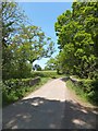
1
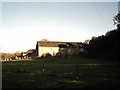
Hayes Barton Farm
Taken from the Tarka Trail
Image: © Grant Sherman
Taken: 17 Nov 2005
0.08 miles
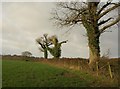
2
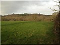
Meadow near Hayes Barton
The field to the right (north) of the trees shown in Image The land is dropping into the wooded valley of a tributary of the Okement. The glimmer of sunshine persists - for a few seconds, at least.
Image: © Derek Harper
Taken: 20 Jan 2012
0.11 miles
3
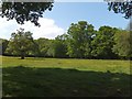
Buttercups in field at Hayes Barton
The field is surrounded by mature trees
Image: © David Smith
Taken: 5 Jun 2013
0.11 miles
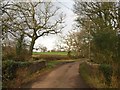
4
Stream at Hayes Barton
The stream's course is several feet below the verge of the road (on left of picture)
Image: © David Smith
Taken: 5 Jun 2013
0.13 miles
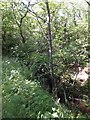
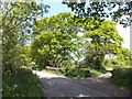
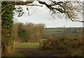
5
Field boundary trees near Hayes Barton
From the lane, followed by both the Tarka Trail & NCN27, between Goldburn Cross and Jacobstowe. Ivy climbs up these hedgerow oaks. A fleeting glimmer of sunshine.
Image: © Derek Harper
Taken: 20 Jan 2012
0.14 miles
6
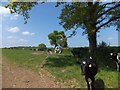
Cattle beside the road to Jaobstowe
The hedge boundary includes the trunk of a dead tree, covered with greenery
Image: © David Smith
Taken: 5 Jun 2013
0.14 miles
7
Bridge, Hayes Barton
An unnamed bridge over an unnamed stream, (at least on the maps), on the Tarka Trail. The lane is also followed by the NCN27.
Image: © Derek Harper
Taken: 20 Jan 2012
0.21 miles
8
Bridge south of Jacobstowe and adjacent field
The bridge crosses a stream which flows into the River Okement close by
Image: © David Smith
Taken: 5 Jun 2013
0.21 miles
9
Bridge south of Jacobstowe
The bridge crosses a stream which flows into the River Okement close by
Image: © David Smith
Taken: 5 Jun 2013
0.21 miles
10
Field access track near Hayes Barton
A view from beside the bridge shown in Image The track turns right at a gate giving a glimpse over a field bordered on the left by the stream crossed by the bridge.
Image: © Derek Harper
Taken: 20 Jan 2012
0.21 miles