
IMAGES TAKEN NEAR TO
Buddle Lane, OKEHAMPTON, EX20 3HX
Introduction
This page details the photographs taken nearby to Buddle Lane, EX20 3HX by members of the Geograph project.
The Geograph project started in 2005 with the aim of publishing, organising and preserving representative images for every square kilometre of Great Britain, Ireland and the Isle of Man.

There are currently over 7.5m images from over14,400 individuals and you can help contribute to the project by visiting https://www.geograph.org.uk
Image Map
Images are licensed for reuse under creativecommons.org/licenses/by-sa/2.0
Notes
- Clicking on the map will re-center to the selected point.
- The higher the marker number, the further away the image location is from the centre of the postcode.
Image Listing (110 Images Found)
Images are licensed for reuse under creativecommons.org/licenses/by-sa/2.0
Image
Details
Distance
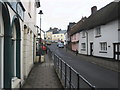
2
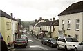
Bridge Street, Hatherleigh
On a wet day, from the junction shown in Image
Image: © Derek Harper
Taken: 15 Aug 2013
0.02 miles
3
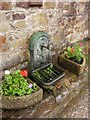
Roadside tap, High Street, Hatherleigh
Mapped as a well, this is outside number 5.
Image: © Derek Harper
Taken: 15 Aug 2013
0.02 miles
4
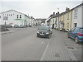
Bridge Street, Hatherleigh
With a co-operative supermarket on the left (with three cars parked at right angles to the street) and the church spire of St John the Baptist visible in the distance.
Image: © John Baker
Taken: 26 Mar 2013
0.03 miles
5

Granite blocks outside double doorway, Hatherleigh
Image: © David Smith
Taken: 21 Aug 2017
0.03 miles
6
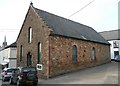
Baptist Chapel, High Street, Hatherleigh
Dated 1879. Now the Vine Chapel according to the sign, but their website http://www.findachurch.co.uk/churches/ss/ss50/vine/states that they now meet in a modern community centre down by the main road. The old chapel is a church hall that other organisations can hire. They are still Baptists, but are "experimenting with the concept of church with choice".
Image: © Humphrey Bolton
Taken: 10 Apr 2010
0.03 miles
7
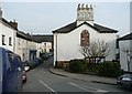
High Street , Hatherleigh
The house on the right has an unusual chimney, and a convenient blank wall and gable for the Hatherleigh Millennium plaque.
Image: © Humphrey Bolton
Taken: 10 Apr 2010
0.03 miles
8

Millennium plaque, Hatherleigh
Not the millennium of 2000-1, but the town's millennium in 1981. The silver band is represented by a trombone and a bass drum.
Image: © Humphrey Bolton
Taken: 10 Apr 2010
0.03 miles
9
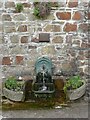
The Buddle well, High Street, Hatherleigh
First recorded in 1650.
Image: © Humphrey Bolton
Taken: 10 Apr 2010
0.03 miles
10

Hatherleigh town centre
The last of Market Street before the junction where High Street branches off to the left beside the building shown in Image
Image: © Derek Harper
Taken: 15 Aug 2013
0.03 miles