IMAGES TAKEN NEAR TO
Inwardleigh, OKEHAMPTON, EX20 3AL
Introduction
This page details the photographs taken nearby to EX20 3AL by members of the Geograph project.
The Geograph project started in 2005 with the aim of publishing, organising and preserving representative images for every square kilometre of Great Britain, Ireland and the Isle of Man.

There are currently over 7.5m images from over14,400 individuals and you can help contribute to the project by visiting https://www.geograph.org.uk
Image Map
Images are licensed for reuse under creativecommons.org/licenses/by-sa/2.0
Notes
- Clicking on the map will re-center to the selected point.
- The higher the marker number, the further away the image location is from the centre of the postcode.
Image Listing (5 Images Found)
Images are licensed for reuse under creativecommons.org/licenses/by-sa/2.0
Image
Details
Distance
1
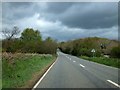
Lamerton Bridge
The bridge is hardly noticeable on the A386, but must have been a landmark in the past to be given a name
Image: © David Smith
Taken: 9 May 2013
0.03 miles
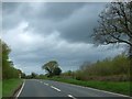
2

Prisam Lane / A386
Turning for the small village of Inwardleigh.
Image: © Fernweh
Taken: 11 Jul 2014
0.10 miles
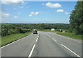
5
Lamerton Cross
The A3072 branches off the A386 Okehampton-Hatherleigh road, which then crosses the Beckamoor Brook valley.
Image: © Derek Harper
Taken: 20 May 2007
0.24 miles