
IMAGES TAKEN NEAR TO
South Tawton, OKEHAMPTON, EX20 2RQ
Introduction
This page details the photographs taken nearby to EX20 2RQ by members of the Geograph project.
The Geograph project started in 2005 with the aim of publishing, organising and preserving representative images for every square kilometre of Great Britain, Ireland and the Isle of Man.

There are currently over 7.5m images from over14,400 individuals and you can help contribute to the project by visiting https://www.geograph.org.uk
Image Map
Images are licensed for reuse under creativecommons.org/licenses/by-sa/2.0
Notes
- Clicking on the map will re-center to the selected point.
- The higher the marker number, the further away the image location is from the centre of the postcode.
Image Listing (8 Images Found)
Images are licensed for reuse under creativecommons.org/licenses/by-sa/2.0
Image
Details
Distance
1
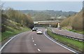
West Devon : The A30
The A30 heading through the county of Devon.
Image: © Lewis Clarke
Taken: 23 Feb 2014
0.14 miles
2
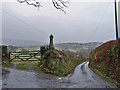
Oxenham Cross
The Dartmoor's Crosses website reports: "This ancient cross has been very badly treated over the years. Mr Ormerod reported, at some time during the 19th Century, that only a portion of the shaft was to be seen and that the head and arms were missing. William Crossing, however, found the missing upper part of the cross lying amongst some stone rubble in a nearby hedge. Although the two parts were joined together, it was later found again, by Mr Masson Phillips, lying on top of the hedge. It was finally restored to its present position by the Dartmoor Preservation Society in 1951."
(Website - http://www.dartmoor-crosses.org.uk/ ).
Image: © Richard Dorrell
Taken: 23 Mar 2010
0.17 miles
3
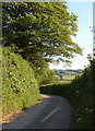
Lane at Oxenham Cross
The lane on the immediate right of Image, curving away to follow the valley in the background.
Image: © Derek Harper
Taken: 8 Jun 2006
0.18 miles
4
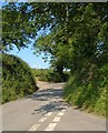
Oxenham Cross
Taken from below the cross shown in Image The junction is staggered, the lane from South Tawton to Ringhill Cross meeting first the lane on the right to South Zeal and then that on the left to Spitlar Cross.
Image: © Derek Harper
Taken: 8 Jun 2006
0.18 miles
5
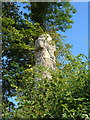
Oxenham Cross
Another view of Image, which shows the cross less entangled with summer growth. There is a listed building description at http://www.britishlistedbuildings.co.uk/en-94956-oxenham-cross-south-tawton , but the site mentioned by Richard is more informative http://www.dartmoor-crosses.org.uk/oxenham.htm .
Image: © Derek Harper
Taken: 8 Jun 2006
0.19 miles
6
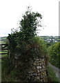
Old Wayside Cross - Oxenham Cross, west of Oxenham Manor
Oxenham Cross, old head, shaft and base Starkey No.65 by the UC road, in parish of South Tawton (West Devon District), crossroads just West of entrance to Oxenham Manor, high on a bank, beside the field gate.
Grade II listed. List Entry Number: 1326092
https://historicengland.org.uk/listing/the-list/list-entry/1326092
Surveyed
Milestone Society National ID: DVWD_STA03.
Image: © Alan Rosevear
Taken: 19 Jun 2009
0.19 miles
7
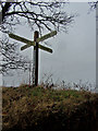
Fingerpost at Oxenham Manor Cross
This modern version of a way marker stands on top of a wall close to a much more ancient signpost - see Image
Image: © Richard Dorrell
Taken: 23 Mar 2010
0.19 miles
8

A30 past Trundlebeer
Coming downhill from around 240m ASL (although the road is in a cutting).
Image: © Julian P Guffogg
Taken: 9 Aug 2013
0.23 miles