
IMAGES TAKEN NEAR TO
South Zeal, OKEHAMPTON, EX20 2PQ
Introduction
This page details the photographs taken nearby to EX20 2PQ by members of the Geograph project.
The Geograph project started in 2005 with the aim of publishing, organising and preserving representative images for every square kilometre of Great Britain, Ireland and the Isle of Man.

There are currently over 7.5m images from over14,400 individuals and you can help contribute to the project by visiting https://www.geograph.org.uk
Image Map
Images are licensed for reuse under creativecommons.org/licenses/by-sa/2.0
Notes
- Clicking on the map will re-center to the selected point.
- The higher the marker number, the further away the image location is from the centre of the postcode.
Image Listing (29 Images Found)
Images are licensed for reuse under creativecommons.org/licenses/by-sa/2.0
Image
Details
Distance
1

House on the old A30, between two lanes, looking south
Image: © Rob Purvis
Taken: 27 May 2018
0.12 miles
2
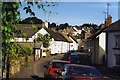
South Tawton: South Zeal
A borough was created here in 1299, providing for a market and two fairs. South Zeal was on the old road from Exeter to Okehampton. At the end of the 18th century the village was bypassed by the Okehampton turnpike, running to the south and skirting Dartmoor. Today this route, too, has been superseded by the dual-carriageway A30 opened in the 1980s.
Image: © Martin Bodman
Taken: Unknown
0.14 miles

4
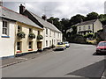
Main Street, South Zeal
The eastern end of the main street in South Zeal.
Image: © Tony Atkin
Taken: 2 Aug 2013
0.15 miles
5
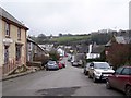
South Zeal
The lower end of the village, seen from just below St Mary's chapel.
The village stores is on the left, http://www.geograph.org.uk/photo/1092529 , and the Oxenham Arms pub on the right http://www.geograph.org.uk/photo/1092524 .
Image: © Richard Dorrell
Taken: 25 Dec 2008
0.17 miles
6
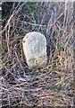
Old Boundary Marker by the former A30, east of Ramsley
Parish Boundary Marker by the UC road (was A30), in parish of Sticklepath (West Devon District), 100m East of turn into cut off section of old road and parking area, in hedge bank, tight by road, opposite hedge row.
Inscription reads:- : BB :
Carved benchmark on lower face.
Surveyed
Milestone Society National ID: DV_LAEX21pb
Image: © Alan Rosevear
Taken: 13 Mar 2013
0.19 miles
7
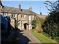
Footpath past cottages at South Zeal
South Tawton Footpath 1 runs past the rear of the cottages which front onto the main street of South Zeal.
Image: © Derek Harper
Taken: 27 Sep 2008
0.21 miles
8
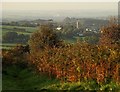
Towards South Tawton from Ramsley Hill
A path descends from the top of Ramsley Hill between high bracken and bramble. The elements in the middle distance are in SX6594, including the tower of South Tawton church. In the distance is Image, about 8 km away.
Image: © Derek Harper
Taken: 27 Sep 2008
0.21 miles
9

Ramsley Lane
This lane lined with cottages runs beneath Ramsley Hill from the old A30 to the south-east end of South Zeal's village street.
Image: © Derek Harper
Taken: 27 Sep 2008
0.22 miles
10
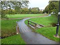
Footbridge over Shelley Brook
Alongside the present bridge are several granite slabs (an earlier bridge?). This is public open space in the village.
Image: © David Smith
Taken: 12 Oct 2011
0.22 miles