
IMAGES TAKEN NEAR TO
Centurian Walk, EX20 1XF
Introduction
This page details the photographs taken nearby to Centurian Walk, EX20 1XF by members of the Geograph project.
The Geograph project started in 2005 with the aim of publishing, organising and preserving representative images for every square kilometre of Great Britain, Ireland and the Isle of Man.

There are currently over 7.5m images from over14,400 individuals and you can help contribute to the project by visiting https://www.geograph.org.uk
Image Map
Images are licensed for reuse under creativecommons.org/licenses/by-sa/2.0
Notes
- Clicking on the map will re-center to the selected point.
- The higher the marker number, the further away the image location is from the centre of the postcode.
Image Listing (13 Images Found)
Images are licensed for reuse under creativecommons.org/licenses/by-sa/2.0
Image
Details
Distance
1
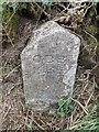
Okehampton Borough Boundary Stone, Chichacott Road
Heading north along Chichacott Road, this is on the left verge beside a field gate. Inscription: "OBB 1935"
Image: © Paul Buck
Taken: 6 Apr 2020
0.11 miles
2
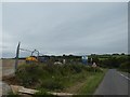
Preparing for new housing, B3215 north-east of Okehampton
Image: © David Smith
Taken: 2 Sep 2020
0.12 miles
3
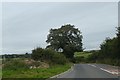
Tree by B3215, edge of Okehampton
The town is expanding along this road; on the left is a developers' fence
Image: © David Smith
Taken: 2 Sep 2020
0.13 miles
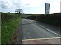
5

New house building on the outskirts of Okehampton
Image: © JThomas
Taken: 9 May 2013
0.15 miles
6
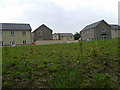
New houses on the east side of Okehampton
Image: © Rob Purvis
Taken: 31 May 2014
0.15 miles
7

Development of houses, edge of Okehampton
Image: © David Smith
Taken: 2 Sep 2020
0.16 miles
8

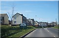
B3215 - Crediton Road
Approaching the outskirts of Okehampton.
Image: © Fernweh
Taken: 15 Mar 2014
0.17 miles
10

Okehampton: site of Roman fort
Looking north west. The fort was constructed in the period after AD 50 and is thought to be contemporary with a legionary fortress at Exeter. Its main axis is aligned north-north-east and it may have stood on the Roman road from Exeter to the west, which ran by a larger establishment at North Tawton. See also: Francis Griffith, Devon’s Past: An Aerial View. Devon Books 1988, 50. The fort was discovered on an aerial photograph in 1975
A Roman road running eastwards from the fort to the next military base towards Exeter, at North Tawton, was discovered circa 2013 during an archaeological dig in advance of proposed residential expansion at Okehampton. It links to the east gate of the fort at Chichacott Lane and was found to be eight metres wide.
The fort was garrisoned between AD50 and AD85.
[Source: Devon Archaeological Society Newsletter 118, April 2014]
Image: © Martin Bodman
Taken: 10 Oct 2007
0.20 miles