IMAGES TAKEN NEAR TO
Hunters Gate, OKEHAMPTON, EX20 1SU
Introduction
This page details the photographs taken nearby to Hunters Gate, EX20 1SU by members of the Geograph project.
The Geograph project started in 2005 with the aim of publishing, organising and preserving representative images for every square kilometre of Great Britain, Ireland and the Isle of Man.

There are currently over 7.5m images from over14,400 individuals and you can help contribute to the project by visiting https://www.geograph.org.uk
Image Map
Images are licensed for reuse under creativecommons.org/licenses/by-sa/2.0
Notes
- Clicking on the map will re-center to the selected point.
- The higher the marker number, the further away the image location is from the centre of the postcode.
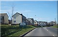
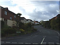
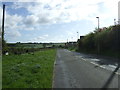
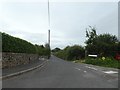
Image Listing (13 Images Found)
Images are licensed for reuse under creativecommons.org/licenses/by-sa/2.0
Image
Details
Distance
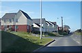
2
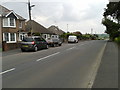
The B3215 in Okehampton, looking north-east
Image: © Rob Purvis
Taken: 31 May 2014
0.06 miles
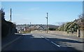
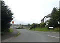
6
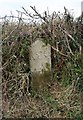
Old Boundary Marker by the B3215, Crediton Road, Okehampton Hamlets Parish
Parish Boundary Marker by the B3215, in parish of Okehampton Hamlets (West Devon District), Crediton Road, opposite No. 90, at side of lay-by, under hedge, North side of road.
Surveyed
Milestone Society National ID: DV_OKCR01bpb
Image: © Alan Rosevear
Taken: 8 Mar 2012
0.11 miles