
IMAGES TAKEN NEAR TO
Roborough, WINKLEIGH, EX19 8SX
Introduction
This page details the photographs taken nearby to EX19 8SX by members of the Geograph project.
The Geograph project started in 2005 with the aim of publishing, organising and preserving representative images for every square kilometre of Great Britain, Ireland and the Isle of Man.

There are currently over 7.5m images from over14,400 individuals and you can help contribute to the project by visiting https://www.geograph.org.uk
Image Map
Images are licensed for reuse under creativecommons.org/licenses/by-sa/2.0
Notes
- Clicking on the map will re-center to the selected point.
- The higher the marker number, the further away the image location is from the centre of the postcode.
Image Listing (29 Images Found)
Images are licensed for reuse under creativecommons.org/licenses/by-sa/2.0
Image
Details
Distance
1
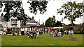
A charity event in Roborough with music, cake & tea
The music was provided by the Alan Lewis Rarebits.
Image: © Roger A Smith
Taken: 30 Jun 2019
0.02 miles
2

Farm buildings in Roborough
Farm buildings on the edge of the small village of Roborough.
Image: © Philip Halling
Taken: 9 Sep 2007
0.04 miles
3
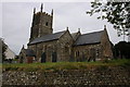
Roborough Church
Roborough church is dedicated to St Peter and dates from the 15th century, it under went restoration in 1868.
Image: © Philip Halling
Taken: 9 Sep 2007
0.04 miles
4
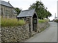
Lych gate for St Peter's church, Roborough
Image: © David Smith
Taken: 14 Jul 2015
0.04 miles
5

Roborough church
St Peter's church, with a 15th century tower
Image: © David Smith
Taken: 14 Jul 2015
0.04 miles
6
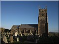
St Peter's church, Roborough
The church has an exceptionally detailed listed building description http://list.english-heritage.org.uk/resultsingle.aspx?uid=1326612&searchtype=mapsearch . As Roborough is a ridgetop village, the C15 tower is a prominent landmark.
Image: © Derek Harper
Taken: 19 Apr 2013
0.04 miles
7
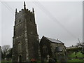
The Church of St Peter at Roborough
Viewed from the south-west.
Image: © Peter Wood
Taken: 2 Apr 2015
0.04 miles
8
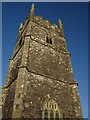
Church tower, Roborough
The tower is C15; see Image and http://list.english-heritage.org.uk/resultsingle.aspx?uid=1326612&searchtype=mapsearch .
Image: © Derek Harper
Taken: 19 Apr 2013
0.05 miles
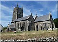
10
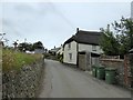
West Road, Roborough
On the left, the churchyard stone wall, with a thatched cottage opposite
Image: © David Smith
Taken: 14 Jul 2015
0.05 miles