IMAGES TAKEN NEAR TO
Marshalls Mead, WINKLEIGH, EX19 8LH

Introduction

This page details the photographs taken nearby to Marshalls Mead, EX19 8LH by members of the Geograph project.

The Geograph project started in 2005 with the aim of publishing, organising and preserving representative images for every square kilometre of Great Britain, Ireland and the Isle of Man.

There are currently over 7.5m images from over14,400 individuals and you can help contribute to the project by visiting https://www.geograph.org.uk

Image Map


Images are licensed for reuse under creativecommons.org/licenses/by-sa/2.0
Notes
  • Clicking on the map will re-center to the selected point.
  • The higher the marker number, the further away the image location is from the centre of the postcode.

Image Listing (24 Images Found)

Images are licensed for reuse under creativecommons.org/licenses/by-sa/2.0
  • ...
Image
Details
Distance
1
1 Marshalls Mead in Snow - first of small housing estate
Feb 09 - snow in Devon at last!! Took this photo of my house early in the morning.
Image: © Dave Price Taken: 6 Feb 2008
0.06 miles
2
Playing field, Beaford
With Image] over a gridline on the left. The field, which includes a playground is sandwiched between the churchyard and Green Lane.
Image: © Derek Harper Taken: 19 Apr 2013
0.10 miles
3
Beaford Garage
Many garages such as this one in the village of Beaford are closed though this one appears to be still trading.
Image: © Philip Halling Taken: 9 Sep 2007
0.11 miles
4
St George and All Saints church, Beaford
The west front of Image] http://list.english-heritage.org.uk/resultsingle.aspx?uid=1105078&searchtype=mapsearch from the north side of the churchyard.
Image: © Derek Harper Taken: 19 Apr 2013
0.12 miles
5
St George and All Saints, Beaford
This 15th century parish church is a Grade I listed building. Extensive renovations were undertaken in the late 19th and early 20th centuries.
Image: © William Cooke Taken: 12 Jul 2009
0.12 miles
6
St George and All Saints church, Beaford
Seen from the adjoining play field. Parts of the building date from the C15 http://list.english-heritage.org.uk/resultsingle.aspx?uid=1105078&searchtype=mapsearch .
Image: © Derek Harper Taken: 19 Apr 2013
0.12 miles
7
Beaford : Green Lane
Beaford Community Primary and Nursery School seen on the corner.
Image: © Lewis Clarke Taken: 4 Dec 2019
0.12 miles
8
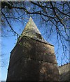
Church spire, Beaford
St George and All Saints church is also shown in Image] and Image
Image: © Derek Harper Taken: 19 Apr 2013
0.12 miles
9
Storm clouds passing south east of Great Torrington
Image: © Roger A Smith Taken: 22 Mar 2014
0.13 miles
10
Exeter Road, Beaford
Bond Street leads off to the right. Beside it are The Beehive and Beehive Cottage, originally C16 http://list.english-heritage.org.uk/resultsingle.aspx?uid=1105079&searchtype=mapsearch , beyond which is the Globe Inn http://list.english-heritage.org.uk/resultsingle.aspx?uid=1146657&searchtype=mapsearch . The road is the A3124.
Image: © Derek Harper Taken: 19 Apr 2013
0.14 miles
  • ...