IMAGES TAKEN NEAR TO
Chenson, CHULMLEIGH, EX18 7LE
Introduction
This page details the photographs taken nearby to EX18 7LE by members of the Geograph project.
The Geograph project started in 2005 with the aim of publishing, organising and preserving representative images for every square kilometre of Great Britain, Ireland and the Isle of Man.

There are currently over 7.5m images from over14,400 individuals and you can help contribute to the project by visiting https://www.geograph.org.uk
Image Map
Images are licensed for reuse under creativecommons.org/licenses/by-sa/2.0
Notes
- Clicking on the map will re-center to the selected point.
- The higher the marker number, the further away the image location is from the centre of the postcode.
Image Listing (28 Images Found)
Images are licensed for reuse under creativecommons.org/licenses/by-sa/2.0
Image
Details
Distance
1
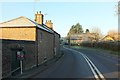
A377 at Chenson
Somewhat similar to Image The main road curves slightly as it passes the cottages in the hamlet.
Image: © Derek Harper
Taken: 30 Nov 2016
0.01 miles
2
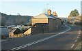
A377 at Chenson
Cottages along the main road on a frosty morning. This looks in the opposite direction to Image
Image: © Derek Harper
Taken: 30 Nov 2016
0.03 miles
3
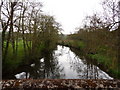
The view downstream from Chenson Bridge on the river Taw
Image: © Roger A Smith
Taken: 11 May 2010
0.04 miles
4
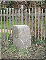
Old Milestone by the A377, Chenson, Chawleigh parish
Carved stone post by the A377, in parish of CHAWLEIGH (MID DEVON District), Chenson, by garden of the old tollhouse, 80m North of Chenson Cottage, on grass verge by fence and garden, on East side of road. Exeter triangle, erected by the Exeter turnpike trust in the 19th century.
Inscription reads:-
: TO / EXON / XIX / MILES : : TO / BARUM / XXI / MILES :
Grade II listed.
List Entry Number: 1309373 https://historicengland.org.uk/listing/the-list/list-entry/1309373
Milestone Society National ID: DV_EXBS19
Image: © Alan Rosevear
Taken: 13 Feb 2012
0.04 miles
5
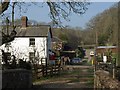
Level crossing, Chenson
Taken from Chenson Bridge over the Taw; the parapets can be seen. The crossing is over Image; the track involved carries Chawleigh Bridleway 2. The white house is the level crossing keeper's cottage. Ahead, the track reaches the A377.
Image: © Derek Harper
Taken: 23 Mar 2011
0.04 miles
6
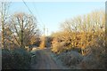
Bridleway, Chenson
Chawleigh Bridleway 1 about to begin a long climb from the Taw valley.
Image: © Derek Harper
Taken: 30 Nov 2016
0.04 miles
7
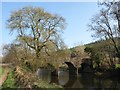
Chenson Bridge
The bridge across the River Taw, seen from the upstream side.
Image: © Derek Harper
Taken: 23 Mar 2011
0.05 miles
8
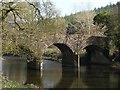
Chenson Bridge
Zooming in on the upstream side of Image It carries Chawleigh Bridleway 2 across the River Taw.
Image: © Derek Harper
Taken: 23 Mar 2011
0.05 miles
9
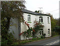
Old Toll House by the A377, Chenson
Toll House by the A377, in the parish of Chawleigh (Mid Devon District), Old Toll Cottage, Chenson, EX18 7LE.
Grade II listed.
List Entry Number: 1309373 https://historicengland.org.uk/listing/the-list/list-entry/1309373
Surveyed
Milestone Society National ID: DV.CHA02
Image: © Alan Rosevear
Taken: 11 Dec 2007
0.05 miles