
IMAGES TAKEN NEAR TO
Colleton, CHULMLEIGH, EX18 7JR
Introduction
This page details the photographs taken nearby to EX18 7JR by members of the Geograph project.
The Geograph project started in 2005 with the aim of publishing, organising and preserving representative images for every square kilometre of Great Britain, Ireland and the Isle of Man.

There are currently over 7.5m images from over14,400 individuals and you can help contribute to the project by visiting https://www.geograph.org.uk
Image Map
Images are licensed for reuse under creativecommons.org/licenses/by-sa/2.0
Notes
- Clicking on the map will re-center to the selected point.
- The higher the marker number, the further away the image location is from the centre of the postcode.
Image Listing (17 Images Found)
Images are licensed for reuse under creativecommons.org/licenses/by-sa/2.0
Image
Details
Distance


3
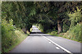
A377 heading north through the trees
The road is following the direction of the River Taw.
Image: © J.Hannan-Briggs
Taken: 20 Jul 2017
0.11 miles
4
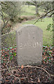
Old Milestone by the A377, north of Leigh Cross, Chulmleigh parish
Carved stone post by the A377, in parish of CHULMLEIGH (NORTH DEVON District), 350m North of Leigh Cross, near Colleton Manor, on muddy grass verge, by low wall of bridge, on West side of road. Barum tombstone, erected by the Barnstaple turnpike trust in the 19th century.
Inscription reads:-
17
BARUM
Devon & Dartmoor HER.
HER Number: MDV76413 https://www.heritagegateway.org.uk/Gateway/Results_Single.aspx?uid=MDV76413&resourceID=104
Milestone Society National ID: DV_EXBS23.
Image: © Alan Rosevear
Taken: 13 Feb 2012
0.14 miles
5
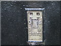
Ordnance Survey Flush Bracket S5172
This can be found on a private dwelling at Leigh Cross.
For more detail see : http://www.bench-marks.org.uk/bm20804
Image: © Peter Wood
Taken: 29 Mar 2015
0.15 miles
7
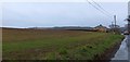
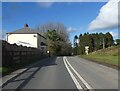
Field at Leigh Cross
The house is at Leigh Cross, where the road from Chulmleigh meets the A377 along the valley of the Taw
Image: © David Smith
Taken: 2 Jan 2013
0.15 miles
8
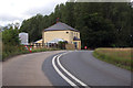
House at Leigh Cross on A377
The crossroads is just beyond the house. The right hand road goes to Chulmleigh.
Image: © J.Hannan-Briggs
Taken: 20 Jul 2017
0.15 miles
9
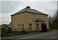
Old Toll House by the A377 at Leigh Cross
Toll House at the junction of the A377 and B3096, in the parish of Chulmleigh (North Devon District), Leigh Cross.
Devon & Dartmoor HER.
HER Number: MDV12016 https://www.heritagegateway.org.uk/Gateway/Results_Single.aspx?uid=MDV12016&resourceID=104
Surveyed
Milestone Society National ID: DV.CHM02
Image: © Alan Rosevear
Taken: 11 Dec 2007
0.16 miles
10

Ordnance Survey Flush Bracket (S5172)
This OS Flush Bracket can be found on Leigh Cross. It marks a point 67.447m above mean sea level.
Image: © Adrian Dust
Taken: 28 Nov 2015
0.16 miles