IMAGES TAKEN NEAR TO
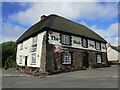
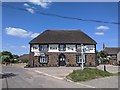
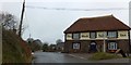
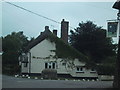
Black Dog, CREDITON, EX17 4QA
Introduction
This page details the photographs taken nearby to EX17 4QA by members of the Geograph project.
The Geograph project started in 2005 with the aim of publishing, organising and preserving representative images for every square kilometre of Great Britain, Ireland and the Isle of Man.

There are currently over 7.5m images from over14,400 individuals and you can help contribute to the project by visiting https://www.geograph.org.uk
Image Map
Images are licensed for reuse under creativecommons.org/licenses/by-sa/2.0
Notes
- Clicking on the map will re-center to the selected point.
- The higher the marker number, the further away the image location is from the centre of the postcode.
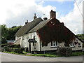
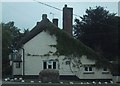
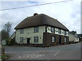
Image Listing (32 Images Found)
Images are licensed for reuse under creativecommons.org/licenses/by-sa/2.0
Image
Details
Distance
1
Bricked over well outside Well Cottage, Black Dog
Image: © Sarah Charlesworth
Taken: 7 Jul 2010
0.00 miles
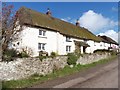
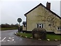
3
Cottages, Black Dog
Date from about 1800 but extended and altered https://historicengland.org.uk/listing/the-list/list-entry/1251323
Image: © Jonathan Thacker
Taken: 17 Sep 2018
0.00 miles
4
Bricked over well outside Well Cottage, Black Dog
Image: © Sarah Charlesworth
Taken: 7 Jul 2010
0.01 miles

7
Covered well at Black Dog, by Well Cottage
Image: © David Smith
Taken: 2 Jan 2013
0.02 miles