
IMAGES TAKEN NEAR TO
Union Road, CREDITON, EX17 3AL
Introduction
This page details the photographs taken nearby to Union Road, EX17 3AL by members of the Geograph project.
The Geograph project started in 2005 with the aim of publishing, organising and preserving representative images for every square kilometre of Great Britain, Ireland and the Isle of Man.

There are currently over 7.5m images from over14,400 individuals and you can help contribute to the project by visiting https://www.geograph.org.uk
Image Map
Images are licensed for reuse under creativecommons.org/licenses/by-sa/2.0
Notes
- Clicking on the map will re-center to the selected point.
- The higher the marker number, the further away the image location is from the centre of the postcode.
Image Listing (188 Images Found)
Images are licensed for reuse under creativecommons.org/licenses/by-sa/2.0
Image
Details
Distance
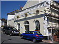
2
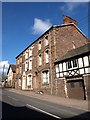
Grove Terrace, Crediton
An ornate facade facing onto Union Road. Note the adjacent premises, of Berry and Vincent, noted local builders in the C19.
Image: © Derek Harper
Taken: 6 Mar 2010
0.02 miles
3
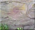
Ordnance Survey Cut Mark
This OS cut mark can be found on the wall opposite No6 Crown Hill Terrace. It marks a point 77.306m above mean sea level.
Image: © Adrian Dust
Taken: 31 Mar 2019
0.04 miles
4
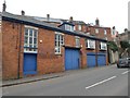
Former garage with ghost sign, Crediton
On the wall the faded words: General engineer garage
Image: © David Smith
Taken: 20 Feb 2019
0.05 miles
5
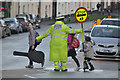
Crediton : East Street
A lollipop man at the crossing on East Street.
Image: © Lewis Clarke
Taken: 13 Nov 2015
0.06 miles
6
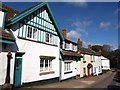
Houses on Church Street, Crediton
These houses face the churchyard and Image Church Street drops down a hill from Union Road, and is followed by the Devonshire Heartland Way.
Image: © Derek Harper
Taken: 6 Mar 2010
0.06 miles
7
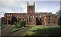
Church of The Holy Cross, Crediton
The most famous building in the town, the church has a long and interesting history dating back over 1000 years. Most of what you see in this picture however, was built in the 15th century. Take a look at this website for more info..
http://www.crediton.co.uk/tourism/town_trail.html
Image: © Mike Crowe
Taken: 15 Oct 2003
0.06 miles
8
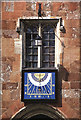
Medieval Clock
A fascinating timepiece to be seen above the doorway of the Church of the Holy Cross in Crediton. As you can see, it was about 14:20 when I took this picture.
Image: © Mike Crowe
Taken: 23 Oct 2003
0.06 miles
9
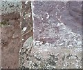
Ordnance Survey Cut Mark
This OS cut mark can be found on the west face of Holy Cross Church. It marks a point 57.279m above mean sea level.
Image: © Adrian Dust
Taken: 31 Mar 2019
0.06 miles
10
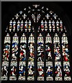
Crediton, Holy Cross Church: The west window
Image: © Michael Garlick
Taken: 9 Aug 2023
0.06 miles