
IMAGES TAKEN NEAR TO
Searle Street, CREDITON, EX17 2HA
Introduction
This page details the photographs taken nearby to Searle Street, EX17 2HA by members of the Geograph project.
The Geograph project started in 2005 with the aim of publishing, organising and preserving representative images for every square kilometre of Great Britain, Ireland and the Isle of Man.

There are currently over 7.5m images from over14,400 individuals and you can help contribute to the project by visiting https://www.geograph.org.uk
Image Map
Images are licensed for reuse under creativecommons.org/licenses/by-sa/2.0
Notes
- Clicking on the map will re-center to the selected point.
- The higher the marker number, the further away the image location is from the centre of the postcode.
Image Listing (69 Images Found)
Images are licensed for reuse under creativecommons.org/licenses/by-sa/2.0
Image
Details
Distance
1
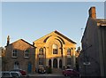
Congregational Chapel and Manse, Crediton
The classical chapel, dating from 1865, has most of its facade in the morning sun; the asymmetrical Manse on the left will have to wait a few minutes. http://www.britishlistedbuildings.co.uk/en-387040-congregational-chapel-and-the-manse-98-c View across the High Street.
Image: © Derek Harper
Taken: 25 Oct 2010
0.07 miles
2
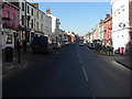
Crediton : High Street
Betfred and Tesco Express can be seen here on Crediton High Street.
Image: © Lewis Clarke
Taken: 13 Feb 2008
0.08 miles
3
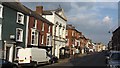
High Street, Crediton
Crediton is not bypassed and traffic is heavy on this street.
Image: © Richard Webb
Taken: 2 Apr 2012
0.08 miles
4
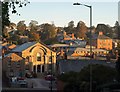
Crediton
A view of part of the western town centre from St Saviour's Way. On the left is Image The square brick building on the right, on Searle Street, is in Image
Image: © Derek Harper
Taken: 25 Oct 2010
0.09 miles
5
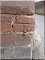
Ordnance Survey Cut Mark
This OS cut mark can be found on No97 High Street. A Hair & Beauty Shop. It marks a point 69.030m above mean sea level.
Image: © Adrian Dust
Taken: 24 Apr 2015
0.09 miles
6
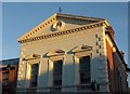
Public rooms, Crediton
The piano nobile and pediment of an 1852 building, as the wording exokains (the 15th year of Victoria's reign) for the Literary Society http://www.britishlistedbuildings.co.uk/en-387065-townsends-crediton . Within the pediment a "moulded roundel in the tympanum with a projecting
bracket at the bottom". The building is on the corner of the High Street and Searle Street (right).
Image: © Derek Harper
Taken: 25 Oct 2010
0.09 miles
7

Conifer, People's Park, Crediton
Red in early morning sun with a heavy frost. The sloping park used to be called Buller Park. Moon on the left.
Image: © Derek Harper
Taken: 25 Oct 2010
0.09 miles
8
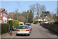
Crediton: Buller Road
Looking north-north-west. The Buller family lived at Downes, a mansion outside the town, from 1726. Its most famous son was Sir Redvers Buller, who relieved Ladysmith in 1900, in the Second Boer War. The town of Redvers in Canada is named after him
Image: © Martin Bodman
Taken: 27 Mar 2007
0.09 miles
9
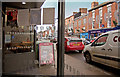
Looking west along Crediton High Street from number 28
Image: © Roger A Smith
Taken: 30 Nov 2018
0.10 miles
10
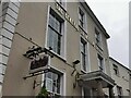
Crediton : The General Sir Redvers Buller
Wetherspoons had announced on November 14 that this pub would not be staying in the hands of the company.
Image: © Lewis Clarke
Taken: 14 Nov 2022
0.10 miles