IMAGES TAKEN NEAR TO
Bickleigh, TIVERTON, EX16 8HF
Introduction
This page details the photographs taken nearby to EX16 8HF by members of the Geograph project.
The Geograph project started in 2005 with the aim of publishing, organising and preserving representative images for every square kilometre of Great Britain, Ireland and the Isle of Man.

There are currently over 7.5m images from over14,400 individuals and you can help contribute to the project by visiting https://www.geograph.org.uk
Image Map
Images are licensed for reuse under creativecommons.org/licenses/by-sa/2.0
Notes
- Clicking on the map will re-center to the selected point.
- The higher the marker number, the further away the image location is from the centre of the postcode.
Image Listing (17 Images Found)
Images are licensed for reuse under creativecommons.org/licenses/by-sa/2.0
Image
Details
Distance
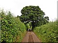
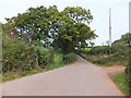
1
Mid Devon : Road to Redgate Farm
A road heading towards Redgate Farm in Mid Devon.
Image: © Lewis Clarke
Taken: 18 Sep 2013
0.06 miles
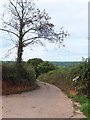
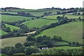
3
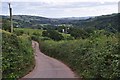
Mid Devon : Country Lane
A country lane heading down the hillside.
Image: © Lewis Clarke
Taken: 18 Sep 2013
0.09 miles
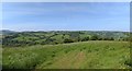
5
Mid Devon : Grassy Hillsides
Looking across the countryside scenery of Mid Devon.
Image: © Lewis Clarke
Taken: 18 Sep 2013
0.10 miles
6
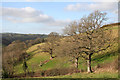
Tiverton: below Rashleighayes
Overlooking the Dart valley, looking north west
Image: © Martin Bodman
Taken: 21 Jan 2006
0.13 miles
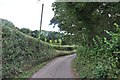
7
Farm track joining the minor road west of Yearlstone
Image: © David Smith
Taken: 17 Oct 2011
0.14 miles
8
Panorama view from the lane near Yearlstone, looking south-west
Image: © Rob Purvis
Taken: 30 May 2016
0.14 miles
9
Mid Devon : Country Road
A country road heading down the hillside into the Exe Valley.
Image: © Lewis Clarke
Taken: 18 Sep 2013
0.14 miles
10
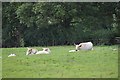
Mid Devon : Cattle Grazing
Cattle grazing in a grassy field on the hillside.
Image: © Lewis Clarke
Taken: 18 Sep 2013
0.14 miles