
IMAGES TAKEN NEAR TO
St. Pauls Square, TIVERTON, EX16 5HZ
Introduction
This page details the photographs taken nearby to St. Pauls Square, EX16 5HZ by members of the Geograph project.
The Geograph project started in 2005 with the aim of publishing, organising and preserving representative images for every square kilometre of Great Britain, Ireland and the Isle of Man.

There are currently over 7.5m images from over14,400 individuals and you can help contribute to the project by visiting https://www.geograph.org.uk
Image Map
Images are licensed for reuse under creativecommons.org/licenses/by-sa/2.0
Notes
- Clicking on the map will re-center to the selected point.
- The higher the marker number, the further away the image location is from the centre of the postcode.
Image Listing (1647 Images Found)
Images are licensed for reuse under creativecommons.org/licenses/by-sa/2.0
Image
Details
Distance
1

Workers' housing and mill, Tiverton
Houses on Church Street for workers at John Heathcoat's lace mill, seen at the end of the street. An interesting feature of this workers' housing is the use of cast iron window sills cast in Heathcoat's own foundry. A little tap with some metal confirmed that the sills were indeed metal. There are several streets of workers houses round here, some more ornate than others. These are among the more 'basic' of the breed.
Image: © Chris Allen
Taken: 10 Jun 2011
0.01 miles
2

Ordnance Survey Cut Mark
This can be found on the wall of St Paul's Church in Tiverton.
For more detail see : http://www.bench-marks.org.uk/bm54934
Image: © Peter Wood
Taken: 30 Mar 2015
0.02 miles
3
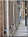
Workers' housing, Tiverton
A zoom view of workers' houses on Church Street showing the cast iron window sills. These houses were for workers at Heathcoat's lace mill and were cast in Heathcoat's own foundry.
Image: © Chris Allen
Taken: 10 Jun 2011
0.02 miles
4
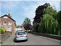
Tiverton : St Paul's Square
A road around the church with houses alongside them. The church itself was funded by John Heathcoat who owned the textile factory.
Image: © Lewis Clarke
Taken: 30 Jun 2009
0.02 miles
5
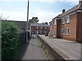
Tiverton : St Paul's Square Path
A path from St Paul's Square towards Kings Street.
Image: © Lewis Clarke
Taken: 30 Jun 2009
0.02 miles
6

St Pauls Church Rooms
St Pauls Church in Westexe, Tiverton, has its church rooms opposite the church itself, which are rented out to the public to run clubs such and Guides, Brownies, Cubs and Tiverton Concert Band
Image: © Emma White
Taken: 6 Jul 2012
0.02 miles
7

Ordnance Survey Cut Mark
This OS cut mark can be found on the NE angle of St Paul's Church. It marks a point 61.774m above mean sea level.
Image: © Adrian Dust
Taken: 19 Feb 2014
0.02 miles
8

Tiverton : St Paul's Church
St Paul's was built by John Heathcoat who built it using the same bricks as his factory.
Image: © Lewis Clarke
Taken: 19 Jun 2007
0.02 miles
9

Tiverton : St Paul's Church Spire
The church spire stands out in parts of Tiverton.
Image: © Lewis Clarke
Taken: 19 Jun 2007
0.02 miles
10

Tiverton : St Paul's Church
All external doorways in the church have studded plank doors with ornate iron strap hinges.
Image: © Lewis Clarke
Taken: 24 Apr 2015
0.02 miles