
IMAGES TAKEN NEAR TO
Tumbling Fields, TIVERTON, EX16 4FG
Introduction
This page details the photographs taken nearby to Tumbling Fields, EX16 4FG by members of the Geograph project.
The Geograph project started in 2005 with the aim of publishing, organising and preserving representative images for every square kilometre of Great Britain, Ireland and the Isle of Man.

There are currently over 7.5m images from over14,400 individuals and you can help contribute to the project by visiting https://www.geograph.org.uk
Image Map
Images are licensed for reuse under creativecommons.org/licenses/by-sa/2.0
Notes
- Clicking on the map will re-center to the selected point.
- The higher the marker number, the further away the image location is from the centre of the postcode.
Image Listing (926 Images Found)
Images are licensed for reuse under creativecommons.org/licenses/by-sa/2.0
Image
Details
Distance
1
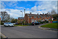
Tiverton : Tumbling Fields
Looking along a road.
Image: © Lewis Clarke
Taken: 30 Mar 2020
0.01 miles
2
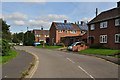
Tiverton : Tumbling Fields
Looking along Tumbling Fields at the edge of Tiverton.
Image: © Lewis Clarke
Taken: 22 Sep 2012
0.03 miles
3

Tiverton : Tumbling Fields Lane
A small residential road.
Image: © Lewis Clarke
Taken: 30 Mar 2020
0.04 miles
4
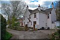
Tiverton : Tumbling Fields Lane
Looking along Tumbling Fields Lane.
Image: © Lewis Clarke
Taken: 30 Mar 2020
0.07 miles
5
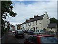
Cottages in St Andrew Street
Strictly, in "St Andrew Street (south)" because the street has been cut in two by the inner by-pass for Tiverton.
Image: © David Smith
Taken: 9 Jun 2011
0.07 miles
6

The Exe Valley way entering Tiverton
St Andrews Street crossing the River Lowman.
Image: © Tim Heaton
Taken: 5 Feb 2025
0.07 miles
7

Tiverton : Tumbling Fields
Tumbling fields on the outskirts of Tiverton looking towards the roundabout with the Great Western Way.
Image: © Lewis Clarke
Taken: 22 Sep 2012
0.07 miles
8
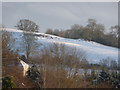
Tiverton : Snowy Hillside
Looking across from the Westexe up to the hillsides.
Image: © Lewis Clarke
Taken: 5 Jan 2010
0.08 miles
9

Former police station in St Andrew Street
This has been converted to residential use (http://www.dhbt.org.uk/Police%20station%20tiverton.html)
Image: © David Smith
Taken: 9 Jun 2011
0.08 miles
10
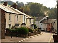
St Andrew Street, Tiverton
Described at http://www.devon.gov.uk/es/index/environmentplanning/public_rights_of_way/where_to_walk_and_ride/daywalks/walk24.htm as: "some attractive urban cottages, built in the early 1800's for the employees of John Heathcoat, the Tiverton clothier and lace maker"
Image: © Derek Harper
Taken: 14 Oct 2009
0.08 miles