IMAGES TAKEN NEAR TO
Clayhidon, CULLOMPTON, EX15 3TN
Introduction
This page details the photographs taken nearby to EX15 3TN by members of the Geograph project.
The Geograph project started in 2005 with the aim of publishing, organising and preserving representative images for every square kilometre of Great Britain, Ireland and the Isle of Man.

There are currently over 7.5m images from over14,400 individuals and you can help contribute to the project by visiting https://www.geograph.org.uk
Image Map
Images are licensed for reuse under creativecommons.org/licenses/by-sa/2.0
Notes
- Clicking on the map will re-center to the selected point.
- The higher the marker number, the further away the image location is from the centre of the postcode.
Image Listing (9 Images Found)
Images are licensed for reuse under creativecommons.org/licenses/by-sa/2.0
Image
Details
Distance
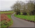
1
Clayhidon : Red Lane
Looking along Red Lane.
Image: © Lewis Clarke
Taken: 31 Dec 2019
0.13 miles
3
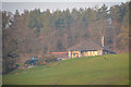
Clayhidon: near Barpark Corner
Looking south east across a side valley of the river Culm. On the Blackdown Hills
Image: © Martin Bodman
Taken: 25 Feb 2006
0.16 miles
5
At Barpark
The head of the valley shown in Image Barpark, on the left, is in Image Taken from the lane into Clayhidon from Barpark Corner.
Image: © Derek Harper
Taken: 18 Jan 2010
0.22 miles
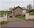
6
Mid Devon : Countryside Scenery
A house in the countryside.
Image: © Lewis Clarke
Taken: 22 Feb 2019
0.23 miles
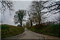
7
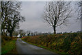
Clayhidon : Country Lane
A country lane in the countryside.
Image: © Lewis Clarke
Taken: 31 Dec 2019
0.23 miles
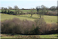
8
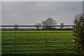
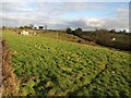
Clayhidon : Grassy Field & Gate
A grassy field beyond the gate.
Image: © Lewis Clarke
Taken: 31 Dec 2019
0.23 miles