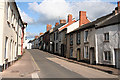
IMAGES TAKEN NEAR TO
Cockpit Hill, CULLOMPTON, EX15 1XX
Introduction
This page details the photographs taken nearby to Cockpit Hill, EX15 1XX by members of the Geograph project.
The Geograph project started in 2005 with the aim of publishing, organising and preserving representative images for every square kilometre of Great Britain, Ireland and the Isle of Man.

There are currently over 7.5m images from over14,400 individuals and you can help contribute to the project by visiting https://www.geograph.org.uk
Image Map
Images are licensed for reuse under creativecommons.org/licenses/by-sa/2.0
Notes
- Clicking on the map will re-center to the selected point.
- The higher the marker number, the further away the image location is from the centre of the postcode.
Image Listing (486 Images Found)
Images are licensed for reuse under creativecommons.org/licenses/by-sa/2.0
Image
Details
Distance
1
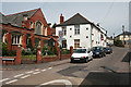
Cullompton: Cockpit Hill from Pound Square
With the Unitarian chapel, one of several denominations in the town, on the left, and an undertaker's beyond
Image: © Martin Bodman
Taken: 24 Jun 2008
0.01 miles
2
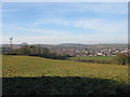
Culm Valley
One of the phone masts feeding Cullompton and surrounding villages looking over the Culm valley
Image: © brian lee
Taken: 5 Jan 2009
0.01 miles

4
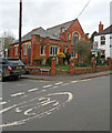
Cullompton: Unitarian Chapel
At the foot of Cockpit Hill
Image: © Martin Bodman
Taken: 6 Apr 2018
0.01 miles
5
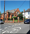
Cullompton: Unitarian Chapel
At the foot of Cockpit Hill
Image: © Martin Bodman
Taken: 6 May 2018
0.01 miles
6

Cullompton: Queen Square
Hardly a square, more a junction of roads. Looking towards Cockpit Hill
Image: © Martin Bodman
Taken: 24 Jun 2008
0.02 miles
7
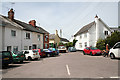
Cullompton: Pound Square
Like nearby Queen Square, hardly a square: more a triangle – a meeting of streets. Just out of shot on the right is the Unitarian chapel, at the foot of Cockpit Hill
Image: © Martin Bodman
Taken: 24 Jun 2008
0.02 miles
8
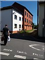
Cullompton: former industrial building
At the point where Duke Street becomes Cockpit Hill. Now converted for residential use. It may have served as part of Sellwood's tannery in the twentieth century
Image: © Martin Bodman
Taken: 6 May 2018
0.02 miles
9
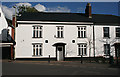
Cullompton: house at the end of Fore Street
At the junction with Cockpit Hill
Image: © Martin Bodman
Taken: 28 Oct 2011
0.03 miles