
IMAGES TAKEN NEAR TO
Honiton Road, CULLOMPTON, EX15 1NZ
Introduction
This page details the photographs taken nearby to Honiton Road, EX15 1NZ by members of the Geograph project.
The Geograph project started in 2005 with the aim of publishing, organising and preserving representative images for every square kilometre of Great Britain, Ireland and the Isle of Man.

There are currently over 7.5m images from over14,400 individuals and you can help contribute to the project by visiting https://www.geograph.org.uk
Image Map
Images are licensed for reuse under creativecommons.org/licenses/by-sa/2.0
Notes
- Clicking on the map will re-center to the selected point.
- The higher the marker number, the further away the image location is from the centre of the postcode.
Image Listing (28 Images Found)
Images are licensed for reuse under creativecommons.org/licenses/by-sa/2.0
Image
Details
Distance
1
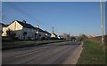
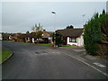
A373 at Stoneyford
The main road from Honiton approaching Cullompton, with a ribbon development of semis on the south side of the road, facing farmland on the north before the road reaches the first house on the right.
Image: © Derek Harper
Taken: 3 Feb 2012
0.01 miles
3
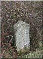
Old Milestone by the A373, Honiton Road, Stoneyford
Carved stone post by the A373, in parish of Cullompton (Mid Devon District), Honiton Road, Stoneyford, opposite No. 6, on grass verge under brambles, on North side of road, next to lamppost. Honiton old gabled stone, erected by the Honiton turnpike trust in the 18th century.
Inscription reads:-
X MILES
(f)rom
HONITON
I
to
CULLOMPTON
Milestone Society National ID: DV_CMHN01
Image: © Alan Rosevear
Taken: 23 Feb 2012
0.03 miles
4
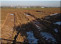
Rutted field entrance, Stoneyford
A view on the other side of a field boundary from Image, with ice filling wheel ruts. Ahead are premises on the Kingsmill Industrial Estate.
Image: © Derek Harper
Taken: 3 Feb 2012
0.05 miles
5

Cullompton: Mole Valley Farmers
Retail outlet on the Honiton road
Image: © Martin Bodman
Taken: 19 Dec 2005
0.08 miles

8
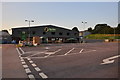
Cullompton : Mole Valley Farmers
The Mole Valley Farmers store on the outskirts of Cullompton.
Image: © Lewis Clarke
Taken: 24 Jul 2014
0.09 miles
9
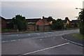
Cullompton : Honiton Road
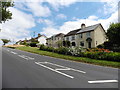
A road in Cullompton heading in from Honiton.
Image: © Lewis Clarke
Taken: 24 Jul 2014
0.09 miles
10
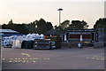
Cullompton : Mole Valley Farmers
The car park and yard outside Mole Valley Farmers in Cullompton including a Kenniford Farm van.
Image: © Lewis Clarke
Taken: 24 Jul 2014
0.09 miles