IMAGES TAKEN NEAR TO
Rawridge, HONITON, EX14 9QP
Introduction
This page details the photographs taken nearby to EX14 9QP by members of the Geograph project.
The Geograph project started in 2005 with the aim of publishing, organising and preserving representative images for every square kilometre of Great Britain, Ireland and the Isle of Man.

There are currently over 7.5m images from over14,400 individuals and you can help contribute to the project by visiting https://www.geograph.org.uk
Image Map
Images are licensed for reuse under creativecommons.org/licenses/by-sa/2.0
Notes
- Clicking on the map will re-center to the selected point.
- The higher the marker number, the further away the image location is from the centre of the postcode.
Image Listing (9 Images Found)
Images are licensed for reuse under creativecommons.org/licenses/by-sa/2.0
Image
Details
Distance
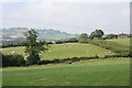
1
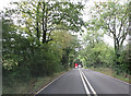
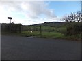
Upottery: Otter valley
Looking south west near the Otter Valley Golf Centre. Dumpdon Hill, belonging to the National Trust and with an Iron Age hillfort atop, is just visible on the skyline, centre
Image: © Martin Bodman
Taken: 28 Jun 2006
0.13 miles
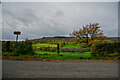
2
Bare trees on the boundary of the Otter Valley Golf Course
The photo is taken from the entrance drive to the golf course, looking south
Image: © David Smith
Taken: 1 Jan 2013
0.16 miles
3
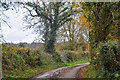
Upottery : Track
A track heads to Claypitts Farm.
Image: © Lewis Clarke
Taken: 13 Nov 2020
0.17 miles
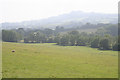
4
Looking across the Otter valley to Hartridge
Image: © David Smith
Taken: 1 Jan 2013
0.17 miles
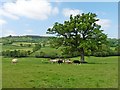
5
Upottery : Grassy Field & Gate
From the road looking out into the countryside.
Image: © Lewis Clarke
Taken: 13 Nov 2020
0.19 miles
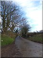
7
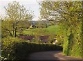
Hayne Farm
Or at least one or two of its buildings glimpsed from the same spot as Image, and looking along the road shown in Image in the opposite direction. The road swings around a side valley of the Otter as it passes the farm.
Image: © Derek Harper
Taken: 22 May 2012
0.21 miles
8
Upottery: Otter valley
Near Hayne Farm, looking north-north-west
Image: © Martin Bodman
Taken: 28 Jun 2006
0.21 miles